Search Icon

Explore Areas in Bangladesh

216 - 234 out of 303 areas
Companiganj Property Guide
Rating icon
3.7

Companiganj
, Sylhet

The Companiganj Upazila is one of the closest locations in Bangladesh to the Bangladesh-India border line. It is also a location with many water bodies, significant tourist spots, industrial zones, and more. So today, you will get to know more about the Companiganj area guide.<br><br> Companiganj was a police station or thana area founded in 1976. However, it was established as an upazila with about 296.90 square kilometers of land area in 1983. According to the 2022 Census, the population of the area is more than 1,92,000, and it is located 30 kilometers from Sylhet Sadar by road.<br><br> Geographically, the upazila is bounded by the Meghalaya State of India in the north, Sylhet Sadar Upazila in the south, Gowainghat Upazila in the east, and Sunamganj District’s Chatak Upazila in the west. The main water bodies of Companiganj Upazila are the Surma River and the Piyain Gang. It also has other haors and beels all around the upazila.<br><br> While the upside of the water bodies in the upazila is that they have naturally beautiful locations, they also have a few drawbacks. Because of the rivers and other waterlines, the Companiganj area suffers from heavy floods every year. Not only does it destroy homes and crops, but it also causes loss of lives due to unexpected disasters.<br><br> Yet, life goes on even in the roughest part of the upazila. Despite the damages, stone and agricultural goods have been two of Companiganj's major economic resources. The Shada Pathor area in Bholaganj is one of the popular tourist destinations for many. People who are visiting that area can lodge in Shada Pathor Hotel & Resort.<br><br> There are other popular locations, such as the Shah Arfin Tila, Mayabon Eco Park, Rauti Beel, High Tech Park Electronics City Sylhet, etc. Companiganj offers good access to educational institutions such as schools, colleges, and madrasas. Yet, the upazila's literacy level is only 28.8%. There are 254 mosques and 31 temples in Companiganj.<br><br> The communication facility from Sylhet Sadar to Companiganj is accessible by buses, cars, and CNGs. However, the village localities of the upazila lack developed concrete or even asphalt roads. But if you are looking for properties in Companiganj, you will find a lot of affordable land for residential, commercial, and industrial purposes.
View Insights
Dighalia Property Guide
Rating icon
3.7

Dighalia
, Khulna

One of the parts of the Khulna District that are divided into multiple land areas by various rivers is the Dighalia Upazila. True to its name, the upazila is surrounded by several water bodies, such as the Bhairab River, Ichamoti River, Atrai River, and the Majudkhali River. In today’s Dighalia area guide, we will explore the beauty, territory, and environment of the upazila.<br><br> The Dighalia Upazila, established in 1983, has a land area of 86.52 square kilometers. It has 6 unions and a population of about 1,15,585. The literacy rate of the upazila is 55.64%, and it has over 70 educational institutes. While a large part of the economy depends on agriculture, fisheries, mango and vegetable cultivation, jute and rice mills, etc., also play a role in the economy.<br><br> The Deara village has a scarred history from the 1971 Liberation War, during which mass murder occurred. The area is also known for other notable architects, such as the Shenhati Shiva Temple, Katanipara Shiva Temple, Kobi Krishna Chandra Institute, etc.<br><br> Other notable landmarks and institutes include Dighalia Police Station, Dighalia Eidgah, Dighalia Ferry Terminal, Bhairab River, Chitra River, etc. Many people also like to visit the Pottery Industry area behind the Sentati Secondary School.<br><br> When it comes to transportation and commuting, there are certain limitations, as the area is bound by rivers. People use rickshaws, vans, bikes, and other mini-transports inside the area. However, if you want to travel to any other part of Khulna from Dighalia, boats, and ferries are the only means of transport as there are no bridges.<br><br> However, one of the good things about this upazila is its beauty and tranquility. The sides of the roads are mostly filled with trees, green open fields, farmlands, and rivers, which are instant mood-boosters.
View Insights
Dumuria Property Guide
Rating icon
3.7

Dumuria
, Khulna

Among the 9 upazilas of the Khulna district, Dumuria is the largest, with a land area of about 454 sq./km. This upazila was established in 1983 and is located about 16 kilometers from Khulna City. Now, it has 237 villages, 204 mouzas, 14 unions, and a population of over 3 lakh.<br><br> This upazila is surrounded by rivers, canals, and other water sources. It is also bounded by multiple other upazilas, unions, and thanas. If you explore the Dumuria area guide, you will find that it has Fultola Upazila in the north, Batiaghata and Paikgacha in the south, Sonadanaga and Batiaghata in the east, and Avaynagar, Manirampur, and Keshabpur in the west.<br><br> The main economic source of this upazila is lobster farming. Other than that, people here grow seasonal vegetables that are sold across the country. Moreover, Dumuria is also known for its home craft and handicraft industry.<br><br> Though Dumuria doesn’t have a lot of historically significant landmarks, it does carry the dark past of the Liberation War of 1971. The Chuknagar Mass Killing Site is one such example.<br><br> Dumuria Upazila is significant for its many religious institutions, with over 230 mosques, 200 temples, and at least 4 churches. It also has over 200 educational institutions. Unfortunately, the area needs more government high schools and colleges. The literacy rate of Dumuria is 55.66%.<br><br> Since the area is near the Khulna City and Moyur Residential Area, it offers promising potential for real estate companies and a commercial target. The land price of the area is also affordable.<br><br> However, a large portion of Dumuria requires a modern makeover and the addition of amenities. While the area is eye-soothing due to its greenery and rural vibe, its lifestyle can certainly improve with time.
View Insights
Elephant Road Property Guide
Rating icon
3.7

Elephant Road
, Dhaka

Elephant Road, a road full of hustle and bustle, is situated between Shahbag Road and the National Science Laboratory. Stationed within New Market thana, Elephant Road accommodates around 67,439 people in 18 wards and falls within the perimeter of Dhaka South City Corporation. <br><br> However, when we think about Elephant Road, images of residences or neighborhoods hardly cross our minds. The Elephant Road area guide always focuses on the focal point of Elephant Road. That is its unique variety of businesses and ventures. From the early 80s till now, this area has been one of the top shopping destinations for Dhaka people. <br><br> Let’s hop on to an imaginary time machine and get to know from where it got such a unique name. During the British period, elephants were abundant in Dhaka, and grazing them was a daunting task. To uproot the problem, lakes near Ramna were appointed. From Pilkhana to Ramna, these elephants would cross the road now known as Elephant Road. <br><br> At the pinpoint of Elephant Road, there is a popular intersection named “Bata Signal.” This name came from the large showroom of the Bata, the shoe brand. Needless to say, there are countless shops and stores that sell various kinds of shoes at very cheap prices. However, here, you need to learn the game of bargaining. <br><br> One location that made Elephant Road popular among young people is the Multiplan Center. This center is a hub for every electronic need, from laptops to desktops. Due to the proximity to Dhaka University and Dhaka College, Elephant Road has become a one-stop shopping solution for clothes, eyewear, shops, and electronics.
View Insights
Ganginar par Property Guide
Rating icon
3.7

Ganginar par
, Mymensingh

Ganginar Par is the heart of Mymensingh city which is known as the lifeline of Mymensingh city. Ganginar Par place belongs to the municipality of Mymensingh district. This Gangina Par located in Mymensingh is a popular garment industry and listed under business services. The place is one of the busiest and commercial areas of Mymensingh. It is a bustling place rich in shops, markets, shopping for all products, educational institutions, nearby hospitals, religious harmony and religious institutions, surrounded by security by the district administration etc. This place portrays a busy image of Mymensingh. Everyday people from different places throng here for business and shopping malls. The place is densely populated. Various types of shops have been built here on both sides of the road where many people are getting employment opportunities. <br><br> Gas, electricity and water supply are adequate. The place is essentially a vibrant hub of Mymensingh offering a mix of shopping, living and working spaces. From the modern shopping malls to the bustling life here, Mymensingh reflects the fast-paced city life. There is also an educational environment with private universities and nearby universities. <br><br> The place being the headquarters of Mymensingh will help you to understand the culture, diversity and heritage of Mymensingh. <br><br> Overall, the place offers a dynamic mix of apparel industry, trade, education system, culture and a diverse lifestyle of Mymensingh which makes it a hub of Mymensingh district city. This place is famous for everything from sightseeing to shopping for products. People from far and wide come here for business purposes, the place represents the heritage of Mymensingh before them.
View Insights
Gazipur Property Guide
Rating icon
3.7

Gazipur
, Dhaka

Gazipur is one of the districts of Dhaka division. As it is located near Dhaka, it is vibrant on one side and has various amenities on the other side. It is a wonderful combination of natural attractions, cultural places and bustling markets. The area of Gazipur is 1741.53 km and the current population is about 5263450. Gazipur has Mymensingh and Kishoreganj districts to the north, Dhaka Narayanganj and Narsingdi districts to the south, Narsingdi to the east and Dhaka and Tangail districts to the west.<br><br> Established in 1984, this district has now become Gazipur City Corporation. It consists of several upazilas including Gazipur Sadar, Kaliakair, Kapasia, Sreepur and Kaliganj. Due to its administrative importance, the district is currently elevated to the City Corporation. District city is constantly crowded with people for administrative work. Located just 25 km north of Dhaka district, this district has emerged as a very developed and important place in the country.<br><br> Gazipur is a major industrial center of Bangladesh, with numerous textile, garment and pharmaceutical factories. Industrial growth is contributing significantly to the development of the area, providing employment opportunities, eliminating unemployment and improving the standard of living of the people here which is truly commendable. At the same time, people of different religions are living together here, representing secularism. Gazipur is home to Bishwa Ijtema, the second largest annual Muslim gathering in the world.<br><br> The distriect the historical depth of this place. It is the home district of the first prime minister of Bangladesh, Tajuddin Ahmed. From agricultural research centers to universities etc. educational institutions are here. Apart from these, there are vibrant markets such as Gazipur Town Market, Bhawal Rajbari Market and other markets in Jaleti. Where a variety of fresh produce to handicrafts are available at your fingertips. There is adequate water and electricity supply.<br><br> There are road and rail systems for transportation. Various types of public transport including buses, trains are easily available here which provides easy access from the district.<br><br> Gazipur has an equable and temperate climate. They have their own regional language, food habits and philosophy. Due to the unplanned construction of factories and buildings, traffic jams and various problems persist. Overall, Gazipur's mix of historical importance, industrial growth, educational excellence and natural beauty has made it a unique and dynamic region within Bangladesh which is a source of great joy for us.
View Insights
Gopalganj Property Guide
Rating icon
3.7

Gopalganj
, Dhaka

Gopalganj is not merely a district of Bangladesh. This place is embedded in the chronicle of the history and emergence of Bangladesh. In the tapestry of Bangladesh’s independence, Gopalganj has inked an indelible mark. Yes, this is the memory-dibbed birthplace of the father of the nation, Bangabandhu Sheikh Mujibor Rahman.<br><br> Undoubtedly, its historical significance ushers many local or foreign tourists to visit the landmarks. In the Gopalganj area guide, we will delve into the core of Gopajganj and will explore some must-visit places. Moreover, we will discuss the prospectus of properties in the area as a developed city in Bangladesh. <br><br> The fresh breath of the Modhumoti River will welcome you wholeheartedly to the city of Gopalganj. This mesmerizing city is located in the southwestern part of our country. This district accommodates a population of over 1,172,415 people, covering an area of approximately 1,468.74 square kilometers.<br><br> Gopalganj's economy is primarily based on agriculture and rice farming. Fishing plays a significant role in keeping the economy afloat. The area is also abundant with lush greenery, vegetation, jute, and other crops.<br><br> After the inauguration of the Padma Bridge, Gopalganj has been witnessing tremendous advancements in trade and commerce. The wide roads and transport facilities have blossomed the area's economy and lifestyle. Recently inaugurated railway stations will also become a beacon of development and progress in the area soon.<br><br> Gopalganj has been hailed for its progress not only in trade and commerce but also in the education and health sectors. Currently, one university and one medical college operate in Gopajganj Shadar. From natural attractions to historical landmarks, Gopalganj stands as a beacon of progress and beauty in our country.
View Insights
Halishahar Property Guide
Rating icon
3.7

Halishahar
, Chattogram

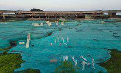
At the bank of the Karnaphuli river and between the Bay of Bengal and Hill Tracts is located Halishahar Thana. It is one of the thriving and prominent areas in Chattogram District. You will need the Halishahar area guide to navigate through it, as it is filled with so many important locations, institutions, heritages, and remarkable landmarks.<br><br> The Halishahar area is about 9.64 sq./km or 3.72 sq./mile under the Chattogram City Corporation. According to the 2022 Census, the area had a population of 234,443, which has increased over the years. From the early days, Halishahar has been one of the busiest areas in the entire Chattogram district. Currently. It is also densely populated and has the district’s largest residential area.<br><br> The city’s name has a significant historical fact. It is said that during the 8th and 9th centuries, it was a temporary settlement location for Arab merchants. It was called the “Hawale City” during that time, which means “City Floor”. And it later turned into Halishahar.<br><br> This coastal area also has significant and busy locations, such as the Chattogram Port, Chattogram EPZ, multiple beach areas, Navy Colony, and Fishery ghats, and many national and commercial companies and their headquarters. As a result, the Halishahar area has many transportation routes, including multiple railway stations.<br><br> Moreover, it has many reputed educational institutions, training and sports centers, parks, conventional halls, medical institutions, religious institutions, shopping complexes, and more. The Chattogram EPZ is the largest export processing zone in the area and 4th (among 700) economic zones in the world. The Halishahar area is home to people of different economic backgrounds. Renting an apartment is very affordable, and the price of buying land or an apartment is also quite competitive.
View Insights
Kanaighat Property Guide
Rating icon
3.7

Kanaighat
, Sylhet

It has been said that there was a boatman named Kanai at the Surma River of Sylhet District. The area is named Kanaighat after him. However, there was no proof of the story, and there are many more tales behind it. Nevertheless, the Kanaighat area guide explores the landscape and beauty of this upazila, located in the northeast of Bangladesh.<br><Br> Though the Kanaighat Upazila was established in 1983, it was a thana of Sylhet since 1880. Now, there are 1 pourashava, 9 unions, and 250 mouzas in the upazila. It has a land area of about 412.25 square kilometers and a population of 3,17,575 (2022 Census). The upazila is bounded by the Meghalaya State of India and Jaintapur Upazila in the north, Beanibazar, and Jakiganj Upazilas in the south, Assam State of India in the east, and Gowainghat, Jaintapur, and Sylhet Sadar upazilas in the west. <br><Br> Being surrounded by several major upazilas and cities, Kanaighat offers broader transportation facilities across the country. Other than offering various communication routes inside the country, Kanaighat also offers transportation facilities beyond the border. However, the upazila roads and streets still suffer from the lack of proper development as there are more mud roads and many bus routes are not wide enough for better-traveling access. Several roads in the Upazila Sadar area are even damaged and have potholes.<br><Br><br><Br> Since the majority of the population in Kanaighat is Muslim, you will find several mosques in each village. There are more than 470 mosques all over the upazila, along with 30 temples and 2 churches. The upazila also has cultural organizations, political and sports clubs, religious services, community centers, banks, financial institutions, etc.<br><Br> Among its over 150 educational institutions, the most notable ones are the Kanaighat Government High School, Kanaighat Government College, Kanaighat Women College, Durgapur High School And College, Jamea Islamia Yousufia Fazil Madrasa, Jhingabari Fazil (Degree) Madrasah, etc.<br><Br> The most remarkable natural resource of Kanaighat is stone. The government earns a lot of revenue from Lovachora Stone Quarry in the upazila. Besides that, agriculture is the main economic source of the people in the upazila, which is about 48%. Other economic sources include non-agricultural labor, business, industries, jobs and services, remittance, etc.<br><Br> Kanaighat Upazila has many popular tourist spots. Among them, the Surma River, Andal Beel, Satbak Andu Lake, Lovachora Tea Estate and Park, East Barchatola Rubber Plantation, etc, are frequently visited by tourists.
View Insights
Keraniganj Property Guide
Rating icon
3.7

Keraniganj
, Dhaka

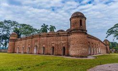
One of Dhaka’s upazilas, Keraniganj gained its historical significance in the liberation war in 1971 when it acted as the base of most guerilla operations. Today, it is a fast-developing city in Dhaka, boasting diverse communities, historical attractions, an improved standard of life, growing businesses and markets, and progressive infrastructure.<br><br> The Keraniganj area guide shows it has two thanas: Keraniganj Model Thana and South Keraniganj Thana. They are surrounded by Mohammadpur, Shyampur, Savar, Narayanganj, Kotwali, Lalbagh, and other places. There are more than 120 mahallas and about 400 villages in the 12 unions of Keraniganj. With an area of 166.87 sq/km, the city is home to around 800,000 people.<br><br> The location of Keraniganj puts it in a strategically advantageous position that has made transportation easy to major routes in crucial regions of the country. Therefore, it gradually emerged as an ideal business zone. The Dhaka-Mawa Highway connects the city to Dhaka, whereas the connection to Khulna and Chattogram is further facilitated in Keraniganj because of the Padma Multipurpose Bridge and Padma Bridge Rail Line.<br><br> Additionally, Keraniganj has become a preferable residential area for many people because of its affordable living cost. The presence of numerous schools and medical facilities has resulted in people from diverse backgrounds moving here. When necessary, they can easily go to the capital to avail of other facilities by using available transportation.<br><br> Finally, apart from locals and businesspeople, food and travel enthusiasts will also find Keraniganj a great place to explore its renowned places and local restaurants.
View Insights
Khalishpur Property Guide
Rating icon
3.7

Khalishpur
, Khulna

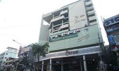
On the outskirts of the Bhairab and Rupsha rivers is located the Khalishpur thana. It is one of the Metropolitan thanas under the Khulna City Corporation (KCC) of the Khulna Division. The geographical area of Khalishpur is 12.35 sq./km.<br><br> And here is more of the Khalishpur area guide. According to data from the Khulna Metropolitan Police, there are more than 235,000 people living in the area.<br><br> Since it is located in the central Khulna district, Khalishpur is an area of growing community, business, and amenities. The Dhaka-Jessore-Khulna Road goes through the middle of the city and offers major transportation facilities. It connects the area to other major locations, such as Daultour, Khulna Cantonment, Boyra, Natun Rastar Mor, etc.<br><br> However, despite the facilities it offers, the Sheikh Abu Naser Bypass Road, which was to be another major road in the city, has been abandoned for around 13 years. This has been causing some issues with the residents around the area to move around comfortably. On top of that, the poor condition of the road often causes minor to major accidents.<br><br> The Khalishpur area has around 30 mosques, 2 temples, and 1 church. The main sources of income in the area are business, transport and construction, rents, remittance, etc.<br><br> While there aren’t many residential areas in the area, the Khalishpur Housing State is one of the well-planned residential areas in this country. Along with the vibrant and changing living conditions, Khalishpur offers modern amenities, such as the Liberty Cineplex, Wonderland Amusement Park, Sheikh Abu Naser Stadium, Rupsha Power Plant, etc.<br><br> Other significant locations include Newsprint Paper Mill, Khulna Junction, Khulna Railway Station, Khalishpur High School, Khulna Public College, Khalishpur Eidgah Field, etc. A location of natural beauty, Khalishpur is slowly transforming into one of the urbanized locations in Khulna.
View Insights
Kishoreganj Property Guide
Rating icon
3.7

Kishoreganj
, Dhaka

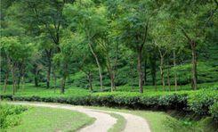
Kishoreganj, previously a sub-district under the Mymensingh District, became a district under the Dhaka Division in 1984. It is the second-largest district under the Dhaka Division. So let’s take a look at the Kishoreganj area guide.<br><br> Kishoreganj has a land area of around 2,689 sq./km, which was taken from the Mymensingh District. According to the 2022 Census, the district's population is about 3,267,626, with a density of 1200 people per square kilometer.<br><br> It is filled with not just the natural beauties of greenery and haors and rivers but also historical lands and heritages to fill your eyes with. So it is no wonder that Kishoreganj City and the District are a land of attraction to many people.<br><br> Some of such notable locations are Austagram haor, Kutub Shah Mosque, Isha Khan's Jangalbari Fort, Chandrabati Temple, Egarosindur Fort, Gangatia Jomidar Bari, etc. Moreover, the Sholakia Eidgah field holds the largest Eid Jamat or congregation in Bangladesh. There are also many other tourist attractions in this district.<br><br> The haors of this district contribute largely to its economy as the fish from this area goes all over the country. Other than that, vegetables, paddy, jute, and poultry farms also play a significant role in Kishoreganj's economy.<br><br> The literacy rate of the district is 72.54% (age 7 or above), and it has many educational institutions. Some of the well-known schools here are Azim Uddin High School, Kishoreganj Model Girls' High School, Kishoreganj Model Boys’ High School, Syed Habibul Huq High School, etc.<br><br> Other notable institutions are Kishoreganj Polytechnic Institute, Kishoreganj Govt. Mohila College, Katiadi Government College, Shahid Syed Nazrul Islam Medical College, Gurudayal Govt. College, Bangabandhu Sheikh Mujibur Rahman University, etc.<br><br> From medical, social, and financial institutions to supermarkets, bazar areas, parks, cinema halls, and necessary public locations, the Kishoreganj district offers pretty much everything necessary. Whether one travels by bus or train, Kishoreganj offers a good communication facility not just on inter-district routes but also with other districts.
View Insights
Malibag Property Guide
Rating icon
3.7

Malibag
, Dhaka

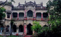
Malibagh is a place in Dhaka, full of life and full of people and traffic. Here you will find people from all walks of life, who came to live in Malibagh and passed generations of time loving the neighbourhood. With a large number of eateries, schools, affordable housing options, and an intricate network of roads, this place is considered a ‘complete’ place for residence by many. Malibagh is a part of Dhaka South City Corporation, Region 2, Ward 12. This area might be small looking, but it is packed with everything a person might need. People of Malibagh don’t need to go anywhere far to meet their basic living needs. The old and rich history of Malibagh truly makes it a unique place to live in. In addition to its bustling streets and vibrant atmosphere, Malibagh is also a haven for community gatherings and celebrations. Parks and recreational areas offer respite from the urban hustle, where families gather for picnics and children play freely. Festivals and cultural events bring the neighborhood to life, showcasing the rich tapestry of traditions that define its identity. From colorful street parades to lively music performances, Malibagh resonates with the joyous spirit of its residents, fostering bonds that transcend the confines of everyday life. In these shared moments of laughter and camaraderie, the true essence of Malibagh shines brightest, as a place where friendships flourish and memories are made. Overall, Malibagh is mostly residential and quite a busy area. Whether you're looking to find affordable homes, shops, restaurants, or hospitals, Malibagh has it all. Despite some problems, it is one of the most demanding places to live.
View Insights
Manikganj Property Guide
Rating icon
3.7

Manikganj
, Dhaka

Though there are several debates about how the name Manikganj came up, it is one of Bangladesh's historically significant districts. Manikganj was established as a district in 1984 under the Dhaka Division.<br><br> Manikganj area guide shows it has a land area of 1,383.66 sq./km. And the population of the district is no less than 1.55 million. The district has 7 sub-districts, 2 municipalities, 603 wards, and 1678 villages.<br><br> Manikganj is filled and surrounded by beautiful landmarks and many historical sites. Some of the popular sites are Tewta Jomidar Bari, Betila Jomidar Bari, Baliati Jomidar Bari, Matta Moth, etc. Other attractions include the Saturia Upazila Complex Mosque, Nahar Garden Picnic Spot, Shahid Rafique Library & Memorial Museum, Paturia Ferry Ghat, etc.<br><br> There are over 166 haats and bazaars in the district that contribute to its economy, along with agriculture and other businesses. The rate of literacy in Manikganj is also excellent, and it has over 800 educational institutions. There are also multiple health complexes in every sub-district of Manikganj.<br><br> People are also attracted to this district due to its many traditional and cultural festivals. Every year, the district gets filled with diverse festive colors as people celebrate the Rath Yatra, chariot festival, various village fairs, sports events, etc.<br><br> Many well-known figures of Bangladesh are also from Manikganj. Some of them are Shahid Rafique Uddin, filmmaker Tareque Masud, singer Mamtaj Begum, Agun, filmmaker late Khan Ataur Rahman, etc.<br><br> When it comes to natural beauty and landscapes, Manikganj offers both rural and urban environments. In recent years, demand for land and modern housing complexes has increased in many of its areas. Roads are also developing with time. Along with many bus routes, very soon, people from Dhaka will be able to travel to Manikganj via train.
View Insights
Oxygen Property Guide
Rating icon
3.7

Oxygen
, Chattogram

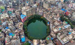
Oxygen is a very important area in the busy city of Chattogram. It is famous for its location because it plays an important role in connecting different parts of the city. This area stands out as a busy hub that combines the comfort of homes with the energy of business activities. It's a key point for people trying to find their way through the city's changing rhythms.<br><br> The best thing about Oxygen is it combines a sense of community and connection so well that it has become the heart of the city. There are many types of homes in the area, so it can accommodate a wide range of people who are looking for the best of both city convenience and neighborhood comfort.<br><br> Oxygen is also famous for having numerous restaurants, markets and other important services that are all easily approachable. That is why it is the center of daily needs and fun activities.<br><br> Oxygen has a wonderful network of roads and is close to many public transit stops, which makes it very easy for people to get around. It is placed strategically so that important parts of Chattogram are only a short commute away.<br><br> Besides commercial and residential options, it has renowned healthcare centers and educational institutions. Oxygen is one of the most popular places to live and do business in Chattogram, even though it doesn't have as many large parks as other parts of the city. This is because it has lively streets, a wide range of services, and a great sense of community.
View Insights
IconMap

Featured Projects

View All

Property Price Trends in Bangladesh for
Buy
Rent
Bedrooms:
Average Price (Last 12 months)
BDT 6,428.06 per sqft
Past 12 months' growth
11.11%
Positive Trend
Past 3 months' growth
13.4%
Positive Trend
Icon
Price information is based on historical data from ads posted on Bikroy and may not reflect the full market dynamics.
hero

Sell or Rent Fast on Bikroy: Post Your Property in 2 Mins!