Search Icon

Explore Areas in Bangladesh

54 - 72 out of 303 areas
Tootpara Property Guide
Rating icon
4.4

Tootpara
, Khulna

Not so far from Khulna City is the Tootpara area, one of the suburbs of the Khulna District. It is located near Khan Jahan Ali Road, which goes from Moylapota Mor to Rupsha Ferry Ghat. It is a part of the Kotwali Thana area and is under the jurisdiction of Khulna City Corporation’s wards no. 28 and 30 (partially). The area is divided into various parts, including West Tootpara and South Tootpara.<br><br> If you check out the Tootpara area guide, you will notice that it is a densely populated area filled with high-raised buildings. That is why the area has less greenery. But that didn’t stop it from becoming one of the important areas of the district. People who seek a modern living facility with easy access to necessary amenities tend to move to the Tootpara area. That is why the residential parts of the area have changed drastically, adding more properties and new amenities.<br><br> Toothpara is accessible by buses, trains, and even ferry ghats, such as the Khulna Railway Station, Rupsha Ferry Ghat, Khan Jahan Ali Road, etc., which are some of its nearby locations. Using the bus routes, people can travel to other locations across the district as well. However, traveling to Tootpara is more convenient by taking a direct bus route to Rupsha Ghat.<br><br> The area is filled with many residential and commercial locations. It has many mosques, along with several Hindu temples. Most of the residents of the Christian Colony, as the name suggests, are Christian, and the area has several churches. There are many educational institutions all around the area. Some of the notable ones are the West Tootpara Government Primary School, West Tutpara Secondary School, Mia Para Government Primary School, Government Sundarban Adarsha College, Khulna Collegiate Girls' School & KCC Women's College, etc.<br><br> The economy of the area depends on businesses and commerce, and many of the people in this area are job holders. It also has several financial institutions, healthcare and diagnostic centers, mills and factories, etc.<br><br> Other notable places of Tootpara are Tootpara Graveyard, West Tootpara Jame Mosjid, South Tootpara Jame Mosjid, Tootpara Puratan Boro Jame Masjid, Khulna Metropolitan Police Headquarters, etc.
View Insights
Habiganj Property Guide
Rating icon
4.3

Habiganj
, Sylhet

Located in the northeastern part of Bangladesh, Habiganj is a district within the Sylhet division. Habiganj has a rich history, dating back to ancient times when it was part of the Bengal Sultanate and Mughal Empire. It is bordered by Sunamganj, Moulvibazar, Kishoreganj, Brahmanbaria, and India’s Tripura.<br><br> Spanning over 2,636.58 square kilometers, it has a population of more than 2.35 million. The Habiganj area guide is sought after and widely recognized for its tea gardens and natural gas fields. The district plays a key role in Bangladesh's economy by supplying tea and energy. Recent developments have improved the living conditions in Habiganj.<br><br> Many people live in rural areas, where agriculture is the main livelihood. However, urban parts of the district, such as the town of Habiganj, are more developed and feature better amenities, including schools, hospitals, and markets. <br><br> The district is well-connected by roads, with highways linking it to nearby cities like Sylhet and Dhaka. The Dhaka-Sylhet highway passes through Habiganj, offering easy access to the capital. Railways and bus services are also available for intercity travel.<br><br> Habiganj is a blend of traditional Bengali practices and tribal influences. It is home to several indigenous groups, and the district celebrates various religious festivals, maintaining religious harmony.<br><br> The education sector is growing, with new schools and colleges being built to cater to the rising population. The economy of Habiganj is primarily based on agriculture, with rice, tea, rubber, and jute being the main crops. Additionally, its natural gas reserves and sand industries are a significant source of revenue.<br><br> Famous spots like Madhabkunda Waterfall and Rema-Kalenga Wildlife Sanctuary showcase the district's natural beauty, making it an attractive destination for nature lovers. The Sagor Dighi or Komola Ranir Dighi of the district is said to be the 2nd largest lake in Bangladesh.
View Insights
Jashore Property Guide
Rating icon
4.3

Jashore
, Khulna

Jashore, which was previously spelled as Jessore, is an administrative and politically significant district of the Khulna Division. It is located in the southeast of Bangladesh and is the 13th largest district of Bangladesh, with a land area of 2,594.94 square miles and a 60 square miles river area. West Bengal of India bounds the Jashore district in the west, Khulna and Narail Districts in the east, Shatkhira and Khulna districts in the south, and Magura and Jhenaidah Districts in the north.<br><br> Jashore is often regarded as the Capital of Flowers. The Jashore area guide notes that the Godkhali area of its Jhikargacha Upazila cultivates and supplies most of the flowers sold across the country. Shrimp cultivation and export have transformed the district’s economy.<br><br> Being an area near the Bangladesh-India border through Benapole, the district has flourished economically by importing and exploring goods. Agriculture, cottage industry, mills, and factories also play vital parts in it.<br><br> During the 1971 Liberation War, Jashore was the first district to be declared independent. It is also the home of many historical and important figures of the country. Many notable landmarks across Jashore are popular tourist spots, such as the Michael Madhusudan Datta Memorial, Egaro Shiva Temple, Dakkhindihi Rabindra Complex, Khan Jahan Ali Dighi, Jashore Cantonment, Jashore Collectorate Park, Godkhali Flower Village, House of Birshreshtha Noor Mohammad Sheikh, etc. <br><br> The district has more than 1200 primary schools, 521 high schools, more than 90 colleges and universities, 40 madrasas, and other educational facilities. Jashore is also diverse in religion, with many mosques and temples all over it.<br><br> It is also a suitable district to live in as housing and land prices are reasonable in many areas. Jashore has good communication facilities with other districts by road, train, and even air.
View Insights
Jhenaidah Property Guide
Rating icon
4.3

Jhenaidah
, Khulna

If you are traveling to the southeast locations of Bangladesh, the first district to greet you will be Jhenaidah. Filled with hundreds of notable locations and residents of many historical figures, the Jhenaidah area guide shows that it is one of the most populated districts of the Khulna Division.<br><br> This picturesque location of the country used to be a subdivision of the Jeshore District. However, it became a separate district in 1984. Now, it has 6 subdistricts, 67 unions, and 1144 villages. Jhenaidah upazila now has a land area of 1,964.77 square kilometers and a population of 20,05,849.<br><br> It is heard that people from West Bengal used to come to the area to collect oyster to collect pearls. Oysters or “Jhinuk” were locally called Jhenai, and “Daha” means large swamp. It is believed that this is how the district got its name.<br><br> The district is now bounded by West Bengal of India and Jashore in the south, Kushtia in the north, Magura and Rajbari in the east, and Chuadanaga in the west. The main water bodies of Jhenaidah District are Kopotakkho River, Bhairab River, Gorai River, Chitra River, etc.<br><br> Jhenaidah is connected to most of the districts of Bangladesh by road. People from neighboring districts can also travel there by train. However, the poor condition of Jhenaidah-Jashore Highway has become a reason of distraught and suffering for the people. <br><br> The district has many reputed educational institutions, such as Islami University, Jhenaidah City College, Jhenaidah Cadet College, Jhenaidah Government High School, Jhenaidah Government Girls' High School, etc. It also has various 283 madrasas and a polytechnic institution. It also has 2,680 mosques, 365 temples, and 16 churches. Some of the most notable historical figures of the district are Birsreshtho Hamidur Rahman, Bagha Jatin, Fakir Lalon Shah, writer Golam Mostafa, etc.<br><br> It also has many historical architectures, such as Sundarpur Jamidar Bari, Abaipur Jomidar Bari, Naldanga Rajbari, Naldanga Temple, Golakata Masjid, etc. People can also enjoy a trip to various parks, resorts, riverview areas across Jhenaidah.
View Insights
Maulvi Bazar Property Guide
Rating icon
4.3

Maulvi Bazar
, Sylhet

Moulvi Bazar is most probably one of the very few areas of Bangladesh that has many historical and eye-catching locations that attract hundreds and thousands of tourists every day. It is located in the Sylhet Division of northeastern Bangladesh. In this Moulvi Bazar area guide, we’ll explore what makes this district special and why it’s an important region in the country.<br><br> Bordering India to the northeast, Moulvi Bazar is nestled in the hills and valleys of Sylhet, offering a peaceful atmosphere and breathtaking landscapes. One of the district's key attractions is its tea industry, which contributes significantly to both the local and national economies. They are also drawing many tourists every year.<br><br> Beyond the tea estates, Moulvi Bazar also boasts beautiful natural landmarks, such as the Lawachara National Park, a biodiversity hotspot home to endangered species and vibrant flora. There are also several eco-parks, hill ranges, waterfalls, and many more natural attractions. <br><br> The people of Moulvi Bazar live in a blend of rural and semi-urban communities. While agriculture remains a primary occupation, the district is seeing growing development in trade and small businesses.<br><br> Moulvi Bazar is a melting pot of traditions. The district has a strong presence of various ethnic groups, such as the Khasia, Manipuri, and others, adding to its rich cultural tapestry. Festivals and religious harmony between communities further highlight the diversity of the region.<br><br> The district is also well-connected by road and railways. This connectivity has fostered economic growth and made it an attractive location for both residents and businesses.
View Insights
Panchagarh Property Guide
Rating icon
4.3

Panchagarh
, Rangpur

If you want to start from the point zero location of Bangladesh, you have to head to the Panchagarh District. Once known for its underdeveloped and underprivileged land area, Panchagarh has transformed into a model district for the country because of its recent development. That is why the Panchagarh area guide is now one of the most sought-after ones by people.<br><br> The Panchagarh district was established in 1984. Its land area is 1,404.63 square kilometers, and its population is about 1.4 million. The district is bound by India’s West Bengal in both north and west. It also has Thakurgaon and Dinajpur districts in the south and Nilphamari in the east. The length of the Bangladesh-India border line in Panchagarh is 288 kilometers.<br><br> Panchagarh also has various rivers flowing through and by it. The most notable ones are the Karatoya, Nagar, Tangon, Mahananda, Chauli, etc. Because of various river sources, Panchagarh has natural resources like sand and stones. Some people believe that the district got its name Pancha (five) Garh (fort) because of five ancient forts located across it. These places are still popular tourist sites.<br><br> Other notable tourist spots here include Chaprajhar Mosque, Mirzapur Shahi Jame Masjid, Moynamotir Chor, Golokdham Temple, Baro Aulia Mazar, Kajal Dighi, etc. There are other modern tourist locations like the Panchagarh Rocks Museum, Tetulia DC Bungalow, Muktanchal Park, etc. You can also get a view of the Kanchenjunga mountain tops from Tetulia of Panchagarh.<br><br> People also like to visit the tea estates that have developed across the district. Panchagarh is the only district in Bangladesh that has successfully established tea estates on flat land areas. Currently, there are more than 18 such tea estates. But that is not the main economy of Panchagarh. The people here rely on agriculture as their main economic source.<br><br> People also cultivate flowers, such as tulips and various fruits, economically and sell them across the country. There are also sugar mills, brick industries, chemical industries, cottage industries, various plants, and more.<br><br> The literacy rate of the district is 51.08%, and there are more than 1800 educational institutions, including colleges and training institutes. Communication is also convenient inside and outside the district.<br><br> Panchagarh is a wonderful place with a serene landscape, but it also has a severe drawback. However, it still needs access to facilities for an upgraded or modern lifestyle.
View Insights
Bagerhat Property Guide
Rating icon
4.3

Bagerhat
, Khulna

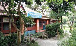
Did you know that Bagerhat is the fourth-largest district in Bangladesh? That’s what makes the Bagerhat area guide more interesting. It is said that since the Sundarbans Mabgrove Forest is part of the area, Bagh, or tigers, used to walk around the localities, and that’s why it is called Bagerhat. Though no one can verify this claim, Bagerhat is still one of the most widely known districts in the country due to its beauty and historical importance. <br><br> Bagerhat has a land area of nearly 3,959 square kilometers. According to the 2022 Census, the district's population is more than 16 million. It was established as a district in 1984. The literacy rate of Bagerhat District is 74.62%, and there are more than 1,300 educational institutions and training centers. The district also has at least 2,514 mosques, 694 temples, and 18 churches. <br><br> Culturally diverse Bagerhat District also offers convenient road communication with almost all the districts in the country. However, it doesn’t have any rail communication facility. The district also offers water transport facilities through various launch and ferry terminals across it. <br><br> The economy of the Bagerhat district depends largely on agriculture. The top agricultural products that grow here are paddy, jute, banana, coconut, sugarcane, potato, and watermelon. The honey collected from the Sundarbans is also a contributor to the economy. There are also various industries, such as cement factories, LPG plants, cottage industries, and garment industries. <br><br> Bagerhat upazila is rich in historial landmarks. The famous Shat Gombuj Mosque, or Sixty Dome Mosque, is in Bagerhat. There are many other similar historical architects, such as Khan Jahal Ali Mazar and Mosque, Khan Jahan Ali Dighi, Khan Jahan Residence Mond, Ghora Dighi, Zinda Peer Mosque, Singair Masjid, the remaining of Reza Khoda Masjid, Ajoddha Math, etc. <br><br> If you want to a taste of modern architecture or go sightseeing, you can enjoy it too. Other than the world-famous Sundarbans Mangrove Forest, you can also visit the Chandra Mahal Eco Park, Badaban Eco-Cottage, Kendua Beel, Dublar Char, etc.
View Insights
Pirojpur Property Guide
Rating icon
4.3

Pirojpur
, Barishal Division

Located in the southwestern part of Bangladesh, Pirojpur District is part of the Barishal Division, known for its scenic rivers and lush green landscapes. Covering an area of about 1,277.80 square kilometers, Pirojpur has a population of approximately 1.2 million people. This Pirojpur area guide provides an overview of what makes the district a charming and vibrant place to live.<br><br> The district is bounded by Gopalganj and Barishal in the north, Barguna in the south, Barguna and Jhalokathi in the east, and Bagerhat and Sundarban to the west. It is said that Subedar Shah Suja’s 2nd son, Feroz Shah, died in this area, which got it the name Ferozpur. However, with time, the pronunciation changed to Pirojpur. <br><br> The district's land varies between town and countryside, with the urban parts like Pirojpur Sadar offering better housing facilities. In contrast, most of the rural parts consist of traditional houses, often made of tin, bamboo, or mud, surrounded by agricultural land and water bodies.<br><br> The town areas are more developed, providing easy access to markets, schools, and healthcare, while rural areas enjoy a quieter lifestyle close to nature but may lack some modern amenities. However, the district is well connected by road and waterways, with frequent bus services linking it to nearby districts and major cities.<br><br> The economy of Pirojpur is predominantly based on agriculture, with rice, guava, and betel leaves and nuts, coconut, etc., playing significant roles. Education is supported by several schools, colleges, madrasas, etc.<br><br> Healthcare facilities include government hospitals and private clinics, but many residents travel to larger cities for specialized treatments. Pirojpur also has numerous religious institutions, including mosques, temples, and churches, reflecting the district's cultural diversity and religious harmony.<br><br> The district's natural beauty is one of its defining features, with rivers like the Baleshwar and Kocha providing stunning landscapes. The district is also dotted with green paddy fields, dense forests, and a variety of wildlife, offering a serene environment for residents and visitors alike.
View Insights
Sreemangal Property Guide
Rating icon
4.3

Sreemangal
, Sylhet

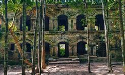
If anyone is looking for a tourist destination in southwest Bangladesh, one of the first locations to come to mind is Sreemangal. Also known as the capital of tea, Sreemangal is one of the most popular locations in the Sylhet Division’s Moulvi Bazar District.<br><br> The Sreemangal area guide shows that the region is situated near the Indian border and enjoys a unique geographical location that contributes to its mild climate. Summers are warm, while winters are cool and comfortable. Yet, it is said to be the coolest location in the country.<br><br> The population of Sreemangal is around 3,61,784, with a blend of ethnic communities, including Bengalis, Manipuris, and Khasias. It has a land area of 450.73 square kilometers. It has one pourashava, 9 unions, and 208 villages.<br><br> The area thrives on agriculture, with tea production being the cornerstone of its economy. Additionally, the cultivation of pineapple, betel leaf, and rubber also plays significant roles in its economic landscape.<br><br> Tourism has been growing steadily due to the area’s natural beauty, further boosting the local economy. The growing hotels and motels offer everything from basic facilities to luxurious holidays for tourists, which is another major economic source of the upazila.<br><br> Living conditions in Sreemangal vary. In urban centers, facilities such as electricity, healthcare, and education are moderately available, though rural areas still face challenges like inadequate access to healthcare and limited modern infrastructure.<br><br> Communication facilities are improving, with access to major highways connecting the town to Dhaka and Sylhet. However, public transportation remains underdeveloped, which can be a drawback for both locals and tourists.<br><br> The area celebrates a variety of festivals, including the Manipuri Ras Lila and the Khasia New Year. Key landmarks include Lawachara National Park, Hail Haor, Baikka Beel, and the sprawling tea estates that define the landscape. Tasting the 7-colored tea of Sreemangal Nilkantha Tea Cabin is mandatory for many first-timers.
View Insights
Kushtia Property Guide
Rating icon
4.3

Kushtia
, Khulna

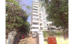
Kushtia is an administrative area of the Khulna District and is located in the southeast of Bangladesh. Kushtia city is the 13th largest town, and its pourashava is the 3rd largest pourashava in the country. Kushtia stands tall with a land area of 1,621.15 square kilometers. According to the 2022 Census, the population of the district is over 2.1 million.<br><br> Kushtia is also called the Cultural Capital of Bangladesh. It has the 2nd largest Shilpakala Academy in the country, and it is also an important industrial zone. The Kushtia area guide shows that the district also has a rich history, and many historical figures, like Mir Mosharraf Hossain, Lalon Shah, Bagha Jatin, etc., are from Kushtia. Moreover, the great poet Rabindranath Tagore also spent a part of his early childhood in this district.<br><br> The Mir Mosharraf Hossain Memorial & Museum, Rabindra Kuthibari and Kachari Ghor, Tagore Lodge, Lalon Shah Mazar, etc., are some of the most frequently visited tourist spots. The Jagati Railway Station is the first railway station in Bangladesh. The Islamic University in Kushtia is the first university of independent Bangladesh.<br><br> Several other landmarks contain the history of the British and Mughal eras, such as the Jubilee Bank, Jhaudia Shahi Mosque, Harinarayanpur Shahi Mosque, etc. Kushtia is also famous for Sesame Seed Candy, locally known as Tiler Khaja, which has been produced in the district for more than 200 years. <br><br> Other than these, the Khoksha Kali Temple has also become a popular attraction, along with the YouTube Village, Kushtia Municipality Museum, Kamrul Islam Siddiqui Park, Moni Park, etc. One can also enjoy a visit to the Madhumati River, Lalon Shah Bridge, Hardinge Bridge, etc.<br><br> The district's economy depends largely on various types of industries. Along with agriculture, farming, non-agricultural labor, education, services, transport, and businesses are helping the district grow economically. However, the district also faces various crises, such as river erosion, water scarcity, flood, waste management problems, etc.
View Insights
Mohakhali DOHS Property Guide
Rating icon
4.3

Mohakhali DOHS
, Dhaka

Mohakhali DOHS is one of the most attractive areas in Dhaka for living. It was first established for the Defence Officers in the mid-1980s. It is like a haven of peace in the busy city of Dhaka. It is known for its well-planned layout and high-end home appeal. Its well-thought-out infrastructure and the way that modern homes and beautiful greenery fit together so well.<br> <br> The main attractional of this place is its well-managed security and ease of access. It has a range of high-end housing choices for people who want the peace of a gated community with the ease of city life. Besides, people who value privacy with safety at Mohakhali DOHS can enjoy privet meals, shopping and other high-end services here without worrying much.<br> <br> Mohakhali DOHS has well-kept roads and key access points that make getting around easy and quick. These roads connect residents to the heart of Dhaka and beyond. Because of its great location, the city's business and entertainment hubs are only a short drive away. This is made possible by its connections to important highways and city roads.<br> <br> Mohakhali DOHS isn't just good for living with family. It's also a great business place, as many of Bangladesh's biggest companies have their head office there. For safety reasons, it's not always open to everyone, but it's a great spot to hang out, shop, and do other activities as well.<br> <br> According to many people, Mohakhali DOHS is one of the most desirable places to live in Dhaka because it offers a unique mix of privacy, safety, and urban elegance. The Mohakhali DOHS is the perfect place to live because it is committed to providing its residents with a good quality of life, is located in a great area, and has a lot of great amenities.
View Insights
Patiya Property Guide
Rating icon
4.3

Patiya
, Chattogram

At least 35 kilometers from the Chattogram Sadar area and near the Karnaphuli River, the Patiya Upazila of the Chattogram District is located. With a land area of about 310 square kilometers and a population of around 3,96,000, it is one of the largest Upazilas in the district. That’s why we will discuss the Patiya area guide in today’s article.<br><br> The Patiya Upazila is surrounded by the Anowara and Chandnaish Upazillas of the south, the Boalkhali Upazila and Karnaphuli River, and the Chattogram City Corporation’s Chandgaon Thana on the North. It also has the Karnaphuli Upazila on the west, the Chandnaish Upazila (partially), and Rangunia Upazila on the east. The well-known Karnaphuli River is its main water body, along with the Shikalbaha, Mjurali, Srimai, and Chankhali canals.<br><br> The communication facility of the upazila has improved since the construction of the Shah Amanat Bridge, the Chattogram-Cox’s Bazar Highway, and several bridges inside the upazila. From buses to smaller vehicles, the roads allow people to enjoy a convenient traveling facility.<br><br> People can also travel to Patiya by train from the Sholashohor Railway Station and other Chattogram rail routes. However, like many other locations of the country, the roads in the village area of Patiya still require major development. <br><br> Economically, Patiya depends on agriculture. It has over 36,900 acres of agricultural land. It is also religiously diverse. You are bound to come across Mosques, Hindu Temples, Buddhist Pagodas, and even a few churches in almost every part of Patiya. That is why the area gets showered with many colors during the festivals.<br><br> It also has many educational institutions, health complexes, upazila parishads, government, non-government offices, etc. The Korean EPZ Corporation Limited is located near the Karnaphuli Dock area of the Upazila. <br><br> For anyone who wants a getaway from bustling and mad city life, Patiya can grant you a peaceful and green gateaway. The Srimai Forest Area is certainly the best area for it. Other historical and notable places here are the Shah Amanat Bridge, Kanchan Valley Eco Village, Akhtaruzzaman Chowdhury Babu Memorial Park, etc.
View Insights
Shib Bari Property Guide
Rating icon
4.3

Shib Bari
, Khulna

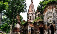
Near the Khulna Railway Station and 5 no. customs terminal of the Rupsha River is a twin Shiva or Shib Temple. It is believed that during the 1104 Bengali Year, Sri Krishna Ram Basu established these temples, which make them over 300 years old. And because of this Shib Temple, the Shib Bari name came up.<br><br> Shib Bari is not a specific location. However, the Shib Bari area guide will tell you that it is located in the SonadangaUp Upazila and Kotwali Thana, under the Khulna City Corporation’s ward no. 17. The Shib Bari Mor or circle, which is located around 1 kilometer from the Shib Temple, is one of the most important and bursting points of the Shib Bari location.<br><br><br><br> The Shib Bari Mor is known for being a commercial and business zone. Many types of businesses have grown over the years, centering around the Mor. From travel and tour guides and shopping centers to community centers and government offices, the area offers access to all the necessary amenities.<br><br> There are several bus stops, and buses travel from Shib Bari Mor to various other routes. You can also take rides in rickshaws, CNGs, autorickshaws, etc. Trucks and other large vehicles can also easily access the roads through this area. On top of that, the Khulna Railway Station is right around the corner from there.<br><br> Other than the temple or the circle, people can travel to the area and visit the Khulna Divisional Museum, BIWTA Launch Terminal, Sangeeta Cinema Hall, and the Rupsha River itself. Though urbanization robbed the area of greenery, Shib Bari and its nearby areas have transformed into one of the sought-after locations for housing and commercial spaces.
View Insights
Anderkilla Property Guide
Rating icon
4.3

Anderkilla
, Chattogram

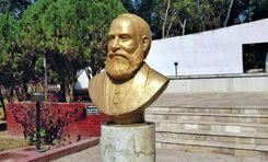
Anderkilla is the 32nd ward under the Chattogram City Corporation. It is situated at the heart of Chattogram, surrounded by Dewan Bazar, Pathorghata, and Bakshirhat on the east, Enayet Bazar on the west, Jamalkhan on the South, and Firingee Bazar on the north. Per the Anderkilla area guide, some notable localities in the ward are Anderkilla, Lal Dighi, Cheragi Pahar, Asadganj, and Khatunganj.<br><br> What sets Anderkilla apart from many areas in Chattogram is its inseparable historical background linking the Mughal regime. Once used as a base for Portuguese pirates, the place became Anderkilla after the Mughals conquered it and built the Anderkilla Shahi Jame Mosque to commemorate their victory. The mosque is renowned to date for its exquisite architecture which will fascinate any tourist. <br><br> Today, occupying 0.77 sq/km of land, the area houses about 25,000 people. There is a law college, a Kamil madrasah, 4 primary schools, and 3 high schools signifying the 80% literacy rate of Anderkilla’s population. <br><br> The ward is doing well from an economic perspective, too. A number of government and non-government banks account for its contribution to the division’s economy. Besides, the markets on the streets and shopping complexes offer the daily amenities of life. From kacha bazaar to junk food or clothing to luxury items, everything is available to lead a comfortable life in Anderkilla. Tourists visiting the place will find it full of life at any time of the day.<br><br> As for transportation, it is highly accessible to the public because of Anderkilla’s advantageous position in Chattogram City. First, it has other important areas around it. Second, it offers different modes of public transportation, i.e., rickshaws, local buses, and CNGs. As a result, people prefer the area for the convenience of easy commutes to go to their workplaces and educational institutions. <br><br> In addition, the ward has multiple hospitals and healthcare facilities providing advanced medical care. Some of them are available 24/7. That is another reason why many want to move to this central part of the city.
View Insights
Bosepara Property Guide
Rating icon
4.3

Bosepara
, Rajshahi

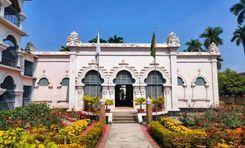
Bosepara is an up-and-coming neighborhood rising near the bank of the Padma River. Although it may not be the largest area-wise, it holds immense significance in the lives of the Rajshahi populace. In this Bosepara area guide, we will delve into Rajshahi's urban hub. <br><Br> Bosepara is situated in the southern corner of Rajshahi, where the Padma River flows nearby. If you happen to live in Bosepara, you can enjoy the gentle breeze of Padma from your balcony. You can also take your morning or evening walk by the bank of Padma, as Bosepara is within walking distance of Padma. <br><Br> But why is Bosepara such a popular hub for residential and commercial purposes? The answer is blowing in the wind. Bosepara's geographical location has provided it with numerous advantages. All the prime locations of Rajshahi are accessible from Bosepara. Many schools, colleges, markets, and entertainment zones are within close range of this area. <br><Br> Shah Makhdum College is right across the street from Bosepara. A top-rated educational institution, Khademul Islam Girl’s School and College, is also within walking distance. Aside from this college, a few academies and one polytechnical institution are also located nearby. That is why Bosepara has many messes, boys' and girls' hostels, and student-friendly residents. <br><Br> Since many students and young adults reside in Bosepara and the adjacent areas, the neighborhood has been surrounded by many markets and restaurants. Bosepara is quite a prospectus for new ventures and business opportunities as the population and demographic are business-friendly. <br><Br> There are many mosques and religious institutions near Bosepara. Ahmadpur Baitul Mamur Jame Masjid and Khorbona Ahle Hadith Jame Masjid are quite acclaimed among Rajshahi people. <br><Br> Another mesmerizing feature of Bosepara is that there are around 4 or 5 ponds inside or near Bosepara. Even though this is a residential area with urban facilities, such a touch of nature makes Bosepara unique and distinctive. Whether you are a family member or a bachelor, you can find your home at Bosepara, which is always there to welcome you warmly.
View Insights
Chuadanga Property Guide
Rating icon
4.3

Chuadanga
, Khulna

The district of Chuadanga is located in the western region of the Khulna division. West Bengal, Meherpur, Jashore, Jhenaidah, and Kushtia border it respectively to the west, south, east, and north. The district used to be a subdivision under the Nadia district before partition. The Chuadanga area guide notes that the area is a land of 1,157.42 square kilometers divided into 4 upazilas: Chuadanga, Alamdanga, Jibannagar, and Damurhuda. Each runs a city under its own name. <br><br> Chuadanga holds great historical significance regarding the Liberation War of the country. In 1971, it was officially announced as Bangladesh’s first capital. It was a crucial war zone where over 100 battles took place between the Mukti Bahini and the Pakistani Military. A mass graveyard where the genocide’s victims were buried is located in the Chuadanga Government Hospital. <br><br> The district’s economy is largely reliant on agriculture, cotton being its cash crop. Around 68% of the labor market is dedicated to the sector, whereas only 12% is engaged in trade and commerce. Despite that, the area shows great promise for industrial development.<br><br> Many groups of industries have been set up in Chuadanga, which have been growing lately, contributing to the country’s economy. Also, these industries are actively recruiting from the local labor force, improving their living standards. <br><br> Another indicator of the area’s potential prosperity is its literacy rate of 71.20%, close to the national literacy rate (74.80%). That is well-accounted for by the notable educational institutions in the district. Regarding transportation, the area is well-connected to its surrounding districts by inter-district highways and railways. <br><br> Housing and other facilities are also available and accessible in the district. As a result, the residents can maintain a decent lifestyle. Historical landmarks, natural spots, and public places in this small district provide ample opportunities for its people to refresh their minds every once in a while.
View Insights
Ishwarganj Property Guide
Rating icon
4.3

Ishwarganj
, Mymensingh

Ishwarganj Upazila, or subdistrict, is located in the Mymensingh district of Bangladesh. It is a region rich in cultural heritage and rural charm. This upazila, spanning an area of 286.19 square kilometers, is home to an estimated 4,04,598 people. There are various opinions regarding the naming of Ishwarganj, but it is most likely derived from the word 'Ishwar,' which may have originated from the name of a landlord or a religious site.<br><br> Currently, it has 1 pourashava, 11 unions, 293 mouzas, and 304 villages. Gouripur Upazila borders it in the north, Nandail Upazila in the south, Kendua Upazila of Netrokona District in the east, and Mymensingh Sadar and Trishal Upazilas in the west. The beautiful Norosunda River also flows through the upazila, even though many parts of it have dried up.<br><br> Ishwarganj is known for its strong community ties and traditional values, which are reflected in the daily lives of its inhabitants. The people of Ishwarganj are known for their hospitality, and the region's rural landscape offers a peaceful retreat from the hustle and bustle of urban life.<br><br> Most residents of Ishwarganj work in agriculture. Rice, jute, and various vegetables are the main crops cultivated here, contributing significantly to the local economy. Transport and other communication rely on roads and highways. However, having three railway stations within the upazila is an added advantage for convenient communication.<br><br> Education is a priority in Ishwarganj, with several primary and secondary schools scattered across the upazila. Many of them were established in the early or late 1900s. However, access to higher education institutions still needs to be improved, prompting many students to travel to nearby towns and cities for further studies.<br><br> Despite these challenges, the literacy rate in Ishwarganj is steadily improving, reflecting the community's commitment to education. The town community is also growing day by day, even though many people live in the rural part.<br><br> You can also explore various historical and interesting places in Ishwarganj. The most notable are the Jomidar Bari and Jomidar Bari pond in Atharobari. There are also the Ishwarganj Boro Jame Masjid, Boro Kalibari Temple, Morichar Chor, etc.
View Insights
IconMap

Featured Projects

View All

Property Price Trends in Bangladesh for
Buy
Rent
Bedrooms:
Average Price (Last 12 months)
BDT 6,428.06 per sqft
Past 12 months' growth
11.11%
Positive Trend
Past 3 months' growth
13.4%
Positive Trend
Icon
Price information is based on historical data from ads posted on Bikroy and may not reflect the full market dynamics.
hero

Sell or Rent Fast on Bikroy: Post Your Property in 2 Mins!