Search Icon

Explore Areas in Bangladesh

90 - 108 out of 303 areas
Mirsharai Property Guide
Rating icon
4.1

Mirsharai
, Chattogram

If you are tired of urban and chaotic city life and looking for a way to get rid of the monotonous routine for some time, a trip to Mirsharai of the Chattogram District might be just what you need. Not only is this area known for its awe-striking hill tract side areas, lakes, waterfalls, or forest areas, but it is also known as an area to live a quiet life far from city life. So, if you are curious to learn more, this Mirsarai area guide will certainly help you. <b><b> The Mirsharai Upazila was established as a Thana in 1917 but was established as an Upazila in 1983. Its 482.89 square kilometer land area is bounded by Chagalnaiya and Feni Upazila and Tripura State of India on the North, Sitakunda Upazila and the Bay of Bengal’s Sandwip channel on the South, Fatikchari Upazila on the East, and Noakhali’s Companigonj Upazila and Sonagazi Upazila on the West. The 2 major water bodies that surround the Upazila are the Feni River and the Muhuri River. <b><b> Its historical and other beautiful landmarks attract people most to this area. It has 5 mass murder sites of the 1971 Liberation War, one mass grave, and one memorial. The Mohamaya Rubber Dam, Thakur Dighi, Moghadia Jomidar Bari, etc., are some of the locally known popular spots. <b><b> However, what makes Mirsharai Upazila a national and international tourist attraction is its forest areas, lakes, and waterfalls that run along the hillside areas. The most popular sites are Napittachhara Waterfall, Khoiyachara Waterfall, Ruposhi Waterfall, and the Bawachora Lake and Waterfall. The Mirsharai Deer Camp, Mohamaya Lake, Eco Park, Arshi Nagar Future Park, etc., are also popular attractions. <b><b> While its tourist spots contribute to its economy, agriculture, fisheries, dairy, and other cultivation are also among the Upazila's main economic sources. The Dhaka-Chattogram Highway has connected Mirsharai to the north, south, and several other cities. People can also travel to the upazila using train routes. <b><b> The Mirsharai Special Economic Zone is the largest economic zone, and it has created employment opportunities for many people over time. With its attractions and heritage, the area is experiencing many developments and is due for more in the coming years.
View Insights
Raozan Property Guide
Rating icon
4.1

Raozan
, Chattogram

Many of us know about the beauty and serenity of the mesmerizing Halda River, and the Raozan Upazila is located near it. The central Raozan city area is about 40 kilometers from the Chattogram Sadar and only around 10 kilometers from the Halda River. So, when exploring the Raozan area guide, you can only expect an eye-catching rural scenario. <b><b> The Raozan Upazila has a land area of 243 square kilometers. It has 76 villages, 60 mouzas, and 14 unions, and the population is around 3,25,389. Other than the Halda River, some parts of the Upazila are located near the Karnaphuli River. The economy of the area depends on fishery from the Halda River, rubber gardens, chili cultivation, and many other agricultural products. Soon, the Raozan BISIC area is expected to create more employment opportunities for the people. <b><b> One of the most convenient ways to travel from Chattogram Sadar to Raozan is by taking the bus route. The Chattogram-Rangamati Highway and Chattogram-Rangunia Highway are two of the major roads connecting the localities of the Upazila to the other parts of Chattogram and other districts. There are also transport options like CNGs, rickshaws, cars, vans, bikes, etc. However, there are no railway routes to the area. The closest railway station is Janali Hat Railway Station, which is approximately 5 kilometers from Madunaghat, the nearest location under Raozan Upazila. <b><b> The Pahartali area, another well-known part of the Upazila, is often recognized widely because of the Chittagong University of Engineering and Technology (CUET). It is one of the most well-reputed educational institutions in the country. Other than CUET, the area has several other notable educational institutions. The Jagatmalla Para mass burial site bears the haunting memory of the 1971 Liberation War of Bangladesh. <b><b> There are many more landmarks and locations in the Upazila, such as Master Surja Sen’s Paternal Home and Memorial, Poet Nabin Chandra Sen’s Paternal Home and Memorial, West Dabua Shiva Temple, Mohamuni Buddhist Temple, Giri Chaya Park View, and Haladia Rubber Garden. This religiously diverse upazila has more than 340 mosques, over 100 Hindu Temples, and 120 Buddhist temples.
View Insights
Alamdangha Property Guide
Rating icon
4.1

Alamdangha
, Khulna

Alamdanaga is an upazila of Chuadanga District, located in the northwest of Bangladesh. It is an administrative area of the Khulna Division, Bangladesh's second-largest division. Alamdanaga was previously a thana area but was established into an upazila in 1982. Its land area is 365 square kilometers, and its population is 3,45,992, with Muslims and Hindus living together for many years.<br><br> Currently, the upazila has 1 pourashava, 15 unions, and 211 villages. Looking at the Alamdanga area guide, you will notice that the upazila doesn’t have many water bodies. Only the Mathavanga River flows through the upazila. It has some small rivers, but most are dried up. However, the upazila still has many large ponds and beels.<br><br> It is now bounded by Mirpur Upazila (Kushtia District) and Gangni Upazila (Meherpur District) in the north, Chuadanga Sadar and Damurhuda Upazila in the south, Harinkunda Upazila (Jhenaidah District) and Kushtia Sadar Upazila in the east. It also has the Gangni Upazila (Meherpur District) and Damurhuda Upazila in the west.<br><br> One of the best things about Alamdanaga Upazila is its growing and developing lifestyle. Over the years, housing and residents, along with roads and other facilities, have been developed. The communication in and out of the upazila is also convenient. In addition to buses and cars, people can also travel through the upazila by train.<br><br> Unlike some other upazila areas of Khulna district, Alamdanga doesn’t have many historical landmarks or notable locations. However, it does have certain popular and notable locations and many old buildings. Some of them are over a century old. The Alamdanga Boddho Bhumi is the mass killing site bearing the scar of the 1971 Liberation War.<br><br> Other landmarks include Alamdanga Laal Bride or railway bridge, Kumari Jomidar Bari, Alamdanga Independence Memorial of 1971, Alamdanga Badminton Club (an ancient building), etc. It also has a cinema hall and a few parks.<br><br> It also has over 120 educational institutions, including madrasa, training institutions, polytechnical institutes, etc. There are 335 mosques, 292 Eidgahs, and 30 temples. People can also access healthcare facilities, banking, and other necessities here in Alamdanga.
View Insights
Gaibandha Property Guide
Rating icon
4.1

Gaibandha
, Rangpur

Gaibandha is one of Bangladesh's notable districts and an administrative area of the Rangpur Division. The district’s areas have a history of more than 5,200 years, so it is no wonder that the Gaibandha area guide shows many historical landmarks from the past.<br><br> Gaibandha was established as a district in 1984. It has a massive land area of 2,114.77 square kilometers and a population of about 2,621,756. The district is bounded by Rangpur and Kurigram districts in the north, Bogura in the south, Dinajpur and Joypurhat in the east, and Kurigram and Jamalpur districts and the Jamuna River in the west.<br><br> Since it is an old land area, Gaibandha is rich in historical and important landmarks. The oldest historical architects are the Gaibandha Khan Bahadur Jamidar Bari, Naldanga Jamidar Bari, and Bardhan Kuthi. The district is surrounded by rivers like Brahmaputra, Teesta, Ghaghat, Karatoya, etc.<br><br> People can go to the ghats or riverside areas to enjoy the picturesque view of the river and take a break from mundane life. If not, there are modern recreational places like the Gaibandha Pouro Park in the district's central area. There are also Dream City Park, Mini Nikli Gobindaganj, Alibaba Theme Park, etc.<br><br> Gaibandha has 5,773 mosques, 892 temples, and a few other religious institutions. It also has 2 cinema halls. There are also over 2,500 educational institutions and several training institutions. To ensure people’s health and safety, there are 64 non-government clinics, 1 general hospital, 1 Upazila health complex, and a few other health centers.<br><br> The district's economy relies on agriculture, which accounts for about 44.45% of the total economic sources. However, small businesses, non-agricultural labor, transport, services, and cottage industries also exist.<br><br> As various other districts surround Gaibandha, you are likely to hear different dialects, which makes the district more diverse. In coming years, Gaibandha is likely to go through more upgrades, with new residential properties on the rise.
View Insights
Mirpur Property Guide
Rating icon
4.1

Mirpur
, Dhaka

Mirpur, located northeast of Dhaka, is one of the most prominent neighborhoods in Dhaka. Surrounded by several important locations and landmarks, it is now part of the Dhaka North City Corporation.<br><br> With a population of over 632,664 in an area of 58.66 square kilometers, Mirpur is undoubtedly one of Dhaka's most densely populated areas. That is why it is essential to be familiar with the Mirpur area guide.<br><br> The statistics show that Mirpur is one of the most sought-after areas by people. That is mainly because it offers affordable housing for both rental and purchase. Moreover, it offers access to many popular restaurants for foodies and has many recreational areas.<br><br> Mirpur 1 is the busiest part of the entire Mirpur area, with lots of shopping malls, departmental stores, restaurants, and bazaars. And now, transportation in and out of the area has become more convenient because of Metro Rail.<br><br> Traveling from the city is easy because of transportation facilities. The area is also popular for various “ghats” that allow you to get closer to the Turag River, and crossing it will take you to other locations easily.<br><br> Two of the most common places that make Mirpur recognizable to many people are the National Zoo and the Sher-E-Bangla National Cricket Stadium, where many national and international events take place.<br><br> Monipur High School and College and Mirpur Cantonment Public School & College are also two reputed educational institutions in the area. Besides these places, the National Botanical Garden of Bangladesh, the National Heart Foundation, and Eco-Park, the area is well-known for having some of the best medical and financial institutions.
View Insights
Mohammadpur Property Guide
Rating icon
4.1

Mohammadpur
, Dhaka

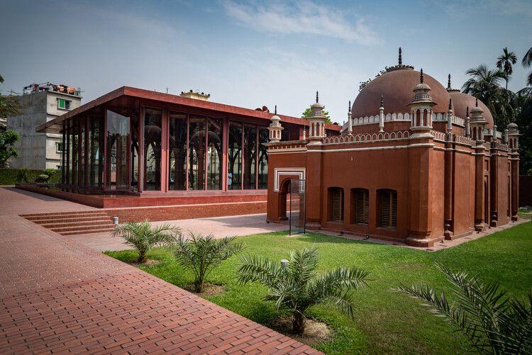
If you look into the Mohammadpur area guide, you will find that the Mohammadpur area is bounded to the east by Sher-E-Bangla Nagar, to the north by Shyamoli and Adabor Thana, and to the south by Dhanmondi and Hazaribagh Thanas.<br><br> It is also connected to Gabtali and Shadar Ghat. Now, this area is part of Zone 5 under Dhaka North City Corporation.<br><br> Like many other parts of Dhaka, Mohammadpur is one of the busiest and most crowded areas. That is probably why this area is notorious for having frequent mugging and other incidents. It seems quite natural, given that more than 527,771 people live in an area of 7.44 sq km, and the security level is not up to the mark.<br><br> Despite having many slum areas, Mohammadpur has grown into a well-planned residential area over time. It is surrounded by greenery and has many historical sites, such as the famous Sat Gombuj Masjid (Seven-Domed Mosque), Badhya Bhumi Smriti Soudha (Martyred Intellectuals Memorial), and many more.<br><br> This residential and commercial hub of Dhaka also has one of the largest apartment blocks in the city, the Japan Garden City. And it is an attractive area for real estate investors with many opportunities for building housing.<br><br> Communication and transportation are also accessible from the area. You can hire rickshaws, CNGs, buses, and cabs to travel anywhere from the area. While the rental price of apartments is quite affordable for the lower and upper-middle-class, buying apartments or lands here can be expensive.<br><br> On top of that, Mohammadpur also offers excellent accommodations for education, medical facilities, banking, finance, recreation, street food, and more. The Dhaka Residential Model College, one of the finest educational institutions in Dhaka, is also in the area.
View Insights
Nasirabad Property Guide
Rating icon
4.1

Nasirabad
, Chattogram

Nasirabad is the most happening residential area in Chattogram. This area is situated at the prime location of Chattogram City. In addition to being a residential hub, Nasirabad is a popular place for commercial activities and a vibrant community. Nasirabad is a significant part of Boalkhali Upazilla.<br><br> Nasirabad can be called the Gulshan of Chattogram City. Being at the heart of the city and replete with diverse urban facilities, this area has attracted affluent and well-off families to set their nests here. Even though the overall area is quite small, it fits the most opulence and grandeur.<br><br> But why such popularity? The main reason is the well-constructed city plan that meticulously designed the area with fashion and convenience. The roads are wide and well-equipped with facilities. The residential areas are packed with amenities and resources for day-to-day life.<br><br> Nasirabad Housing Society is the name of luxury and lavishness. Most affluent houses in the area are located here. The apartments and plots are also costlier than any other part of Chattogram. The spacious and luxurious apartments inside the housing society have made Nasirabad one of the most coveted places in Chattogram.<br><br> Nasirabad has become a name of comfort for affluent families. In addition to the luxurious apartments, the surroundings play a favorable role. As the best educational institutions are situated in Nasirabad, this area has been a trusted location for quality education and tutors.<br><br> In addition to housing facilities, Nasirabad is an adobe for premium shopping malls, eateries, and cafes. Chattogram’s some of the best educational institutions also have set their footing in this area. Nasirabad Govt. High Schools and International Hope School Bangladesh are prominent schools in the area.
View Insights
Nilphamari Property Guide
Rating icon
4.1

Nilphamari
, Rangpur

Nilphamari District is an administrative area of Bangladesh located northwest of the country. It has a 50.90-kilometer border with India. Geographically, Nilphamari is bounded by India’s Siliguri in the north, Dinajpur and Rangpur districts in the south, Rangpur and Lalmonirhat districts in the east, and Dinajpur and Panchagar districts in the west. The most notable water body in the district is the Teesta River.<br><br> The Nilphamari district has a land area of 1,643.40 square kilometers and a population of 20,92,567. It has 6 upazilas, 4 pourashavas, 60 unions, and 378 villages. It is a diverse district with both suburban and rural lifestyles. A big part of the population in Nilphamari relies on agriculture. However, other businesses, such as non-agriculture labor, services, and transport, also play a vital part in the economy.<br><br> Roads and communication have also flourished over the years, with 470 kilometers of developed roads around the district. Traveling around and outside the district by road is highly convenient. People can also travel by trains, as it has 9 railway stations. On top of that, there is an airport in Saidpur Upazila, Nilphamari.<br><br> Mosques, temples, churches, primary schools, high schools, colleges, and technical institutions, Nilphamari offers all the necessary benefits for excellent living conditions. However, climate change and natural disasters strike the land, damaging roads and properties every year. Though there has been an increase in better housing and amenities in recent year, Nilphamari is still faces certain drawbacks like poverty.<br><br> Despite everything, people still like to travel to Nilphamari every year to visit its beautiful landmarks and historical places. Some of the popular ones are the Teesta River view, Chini Masjid, Saidpur Railway Museum, Neelsagar Dighi, Nil Kuthi, etc.
View Insights
Dinajpur Property Guide
Rating icon
4.0

Dinajpur
, Rangpur

Of all the “A” class areas Bangladesh has, Dinajpur is one of the most significant. Not only is it one of the oldest locations, but it is also rich in history. Established in 1786, the best part of the Dinajpur area guide is that it is the largest of the 16 districts in northern Bangladesh. The land area of Dinajpur is 3,444.30 square kilometers, and the population is over 33.15 million. Now, it has 13 upazilas, 9 pourashavas, 103 unions, and 2,131 villages.<br><br> It is said that the founder of Dinajpur Palace was Dinaj or Dinraj. Later, even though the British rule ended, the people named the district Dinajpur. Currently, Dinajpur is a metropolitan district of the Rangpur Division. It is bounded by Panchagar and Thakurgaon Districts in the north, Joypurhat and Gaibandha in the south, Nilphamari and Rangpur in the east, and West Bengal of India in the west.<br><br> The Dhaka-Dinajpur Highway is one of the key roads that connect Dinajpur with many other districts and divisions. Other than roads, people can also travel to the district by train and river. The main rivers in the district are the Karatoya River, Punarbhaba River, Atrai River, etc.<br><br> There are many housing and growing residential areas in Dinajpur. The newly established housings and facilities have impacted the lifestyle in positive ways. As a result, the real estate business is blooming.<br><br> The district's economy relies on agriculture, with the main crops being paddy. However, lychees, mangoes, and other seasonal fruits and vegetables also contribute to the area's economy. Since the amount of food produced in the district is more than the demand, selling and exporting it across the country and internationally contributes largely.<br><br> Dinajpur has many historical landmarks and interesting locations. The most notable ones are the Dinajpur Rajbari, Kantajew Temple, Nayabad Masjid, Sura Masjid, etc. There are also various recreational locations, such as Shopnopuri Artificial Amusement Park, Birganj National Park, Ramsagar National Park, etc.
View Insights
Lalmonirhat Property Guide
Rating icon
4.0

Lalmonirhat
, Rangpur

Lalmonirhat is one of the notable northern districts of Bangladesh, located at the Bangladesh-India borderline. It was previously a mohakuma but was established as a district in 1984. Currently, with a land area of 1,247 square kilometers, Lalmpnirhat is an administrative area of the Rangpur Division.<br><br> The Lalmonirhat area guide shows that the district is bounded by Jalpaiguri and Kuchbihar of West Bengal in the north, the Rangpur District in the south, Kochbihar of West Bengal and Kurigram District in the east, and the Nilphamari and Rangpur Districts in the west. The length of the Bangladesh-India borderline in the district is about 282 kilometers.<br><br> The district's main rivers are Dharla and Teesta. According to the 2022 Census, the population is 14,28,406. The district's literacy rate is 71.18%, and it has around 1,000 educational institutions, including training centers. There are 2,450 mosques, 741 temples, 70 post offices, and 49 banks in Lalmonirhat.<br><br> Communication within the district is available with all types of transport. From Lalmonirhat, people can travel to almost all other districts by road. There are also railway facilities for communication, which benefit trades and businesses within and outside Bangladesh.<br><br> In 2023, Lalmonirhat was declared to be a landless and homeless-free district. Yet, many people lose home and lands due to floods almost every year.<br><br> Nevertheless, Lalmonirhat is still one of the naturally beautiful areas. Some of its popular and notable landmarks are Kalibari Mosque and Temple, Teesta Barrage, Kakina Jomidar Bari, Tushbhandar Jamidar Bari, Mogolhat Port 0 Point, etc.
View Insights
Satkhira Property Guide
Rating icon
4.0

Satkhira
, Khulna

Satkhira, established under the Jashore district in 1861, was declared a full-fledged district to decentralize administration in 1984. Now a district situated in the division of Khulna, the South-western region of the country, the area has a land of 3,817 sq km with Jashore in its north, the Bay of Bengal in its south, the Khulna district in its east, and the West Bengal’s districts of South 24 Parganas and North 24 Parganas in its west.<br><br> According to the Satkhira area guide, the district sits on the scenic Arpangacchia or Betna River’s bank. It comprises 7 upazilas, 8 police stations, and 79 unions. Its 2 municipalities are Satkhira and Kalaura. The former is its biggest city and also the district headquarter. <br><br> But what sets Satkhira apart from other districts in Khulna is its internationally famous Sundarbans, the world’s largest mangrove forest. The forest is not only an amazing tourist spot to have a glance at the incredible wildlife and plants but also plays an important role in serving as the country’s natural shield to provide protection during natural calamities. Also, it contributes to the area’s economy by being the source of livelihood for many locals. Kaliganj Upazila also has a mangrove forest named Basjaria Joarar Ban or BADHA’s forest.<br><br> About the economy, the district is mostly dependent on agriculture. However, it has immense potential for economic development. The Bhomra land port and the production of multiple export goods can bring prosperity in the near future. <br><br><br><br> Another reason Satkhira has a bright future is its growing number of educational institutions. It has 79 colleges, 400+ high schools, 800+ govt. primary schools, and more. The establishment of a medical college and hospital in 2011 further advanced the region’s educational facilities. There are also private healthcare services available for the locals. <br><br> Overall, Satkhira is a beautiful place with abundant natural beauty and economic possibilities. For locals and tourists alike, the district has a lot to offer.
View Insights
Badda Property Guide
Rating icon
4.0

Badda
, Dhaka

A small yet growing neighborhood in northeast Dhaka, Badda has around 200,000 people. With its 9 suburbs and connection to other thanas, such as Gulshan, Baridhara, and Rampura, it is a popular residential area offering all the modern amenities of life.<br><br> According to the Badda area guide, as a part of Dhaka North City Corporation, Badda is an area of 16.78 square kilometers or 6.48 square miles. It is further divided into North Badda and South Badda. North Badda represents the hustling of life with its offices in the Pragati Sarani area, whereas South Badda is a residential place with areas like Aftabnagar and Banasree. Both parts complement each other, making Badda a place for business and residence altogether.<br><br> Public transportation is highly convenient in Badda. First, the Hatirjheel Circular Bus Service offers transportation on many routes in Dhaka. Rickshaws are always available for small distances. Plus, local bus services will take you anywhere in the central regions of the capital.<br><br> Besides, the Hatirjheel Water Taxi Service linking to the Gulshan Lake is a unique and affordable yet entertaining transportation for the area’s people. Within a few years, visiting Badda will be even easier upon the completion of the Dhaka Metro Rail project’s Airport Rail Link or MRT Line - 1.<br><br> While Badda is not the place you would want to choose for fancy dining, the local foods on its ever-living streets will not disappoint you. If you want a taste of South Asian cuisine or our traditional Bengali food, you can check out its restaurants.
View Insights
Bandar Property Guide
Rating icon
4.0

Bandar
, Chattogram

Bandar is a thana or administrative unit in Chittagong. According to the Bandar area guide, its land area is about 20.04 sq./km, surrounded by Double Mooring and Halishahar on its north, the Karnaphuli River and Karnaphuli thana on its east, Patenga on its South, and the Bay of Bengal on the west. It is the residence of over 200,000 people at present, comprising 4 wards and unions with 11 mahallas.<br><br> Among others things, what makes Bandar an important place is the Chittagong Port, one of the crucial economic forces of our country. It is located in the Bandar thana, right on the mouth of Karnaphuli river. This made the place an important hub of trade for the country while giving its people a close relation to its natural elements.<br><br> Apart from commercial significance, the area also holds historical significance. The thana’s naval commandos who fought in the Liberation War conducted multiple successful missions against the Pakistani military. Today, it is one of the busiest places in Chittagong, swarmed with different markets and institutions that cater to the needs of locals and tourists altogether. <br><br> To start with markets, Bandar has Bandar Bazar, Saber Plaza, City Corporation Market, Jalal Plaza, Fakir Hat, Steel Mill Bazar, Yasin Mistry Hat, and more. Some noteworthy establishments around the thana are Chittagong EPZ, Navy Hospital Residential Area, Bandar Bhaban, Port Colony, Shipping Corporation Bhaban, Seamen’s Hotel, and Port Trust Officers’ Colony. These parts of the area make it a vibrant place, beating with the hubbub of life. <br><br> Bandar also has a number of religious institutions of different religions, demonstrating the diversified backgrounds of its population, i.e., Bandar Tila Ali Shah Mosque, East Colony Buddhist Temple, Nischintapara Jami Mosque, Umar Shah Mazar, S Alam Mosque, Ananadabazar Kali Temple, Sree Sree Kali Bari Cremation Temple.<br><br> Besides, there are also noteworthy educational institutions to improve the literacy rate of its population, which stands at 72.6% now. As for transportation and communication, Bandar's connection with other corners of the division is well-established because of its economic importance. Also, the availability of public vehicles ensures easy commutes for its people.
View Insights
Faridpur Property Guide
Rating icon
4.0

Faridpur
, Dhaka

Faridpur is a district of Dhaka Division, known for its rich history, cultural heritage and agricultural significance. This district was established on the banks of Padma river in 1815. Faridpur is a junction point of transport in southern Bangladesh. Earlier the name of the city was Fatehabad. The total area of ​​Faridpur district is 2052.86 km and the present population is 2126.879. It is one of the oldest cities in Bangladesh. It has Rajbari and Manikganj districts to the north, Gopalganj districts to the south, Magura and Narail districts to the west and Madaripur and Munshiganj districts to the east. The district has a rich history dating back to the Mughal era.<br><br> The economy of Faridpur is mainly based on agriculture. The district is known for producing high quality jute. Apart from agriculture, Faridpur has various small-scale industries including textiles, rice mills and handicrafts. The jute industry in particular plays an important role in the local economy. Faridpur district is also an important center of hilsa fish and jute traders.<br><br> Surrounded by natural beauty, this district is highly livable. People of different religions and castes live together here. Which is a very important aspect for living here. From any district of Bangladesh, the transportation system to Faridpur is quite good. In this regard, roads and railways are particularly significant. After the Padma Setu was opened, the communication system of this district has improved more. Along with this, the possibility of construction and expansion of new industries and mills has been created. Along with the communication system, the education system and medical services are also very good here. Jute industry is characterized by the employment of many people which is a part of the need for livelihood here.<br><br> Faridpur has its own history and traditions, its own regional language and culinary diversity. Traditional folk music and routines are an integral part of this celebration. Although it is a Muslim-majority area, unique religious festivals are also celebrated here. Apart from this, Faridpur has several heritage sites and tourist centers which play a very important role in highlighting this significance. Among these, Mujibnagar, Faridpur Museum and River Landscapes are worth mentioning.<br><br> Faridpur district has ample supply of water, electricity and gas. The district has a primarily agricultural environment with fertile plains enriched by the Padma River and its tributaries. Tropical climate prevails here. Faridpur's environment also faces challenges such as river erosion and flooding that affect local communities and agriculture. Efforts to address these issues through sustainable practices and infrastructural improvements to protect and preserve the district's natural resources and agricultural productivity continue.
View Insights
Fatikchari Property Guide
Rating icon
4.0

Fatikchari
, Chattogram

The largest upazila in the Chattogram District is Fatikchari. Its land area is 773.55 square kilometers, and its population is 6,61,158 (2022 Census). The Fatikchari area guide shows that it is located 45 kilometers north of the Chattogram Metropolitan City area. It has 2 thanas, 2 pourashavas, and 18 unions. Like many other locations in Chattogram, Fatikchari is a rural land area filled with many natural attractions.<br><br> Fatikchari is bounded by many other upazilas and locations. It has India’s Tripura in the North, Kawkhali (of Rangamati District) and the Hathazari Upazila in the South, and Mirsharai and Sitakunda Upazilas in the West. It also has Raozan, Ramgarh, Lakshmichhari, and Manikchhari Upazilas in the east. With all the areas and a diverse population, Fatikchari stands to be a land known for its rich history, cultural heritage, remarkable landmarks, and many more things.<br><br> The history of this land began during the rule of Mughal Emperor Aurangzeb when Chattogram was known as Islamabad. Fatikchari became one of the ruling divisions of Mughal Ruler Shaista Khan’s son, Bujurg Umid Ali Khan. The area was known as Ichapur Pargana. Later, it was named Fatikchari after the renowned Baro-Bhuiyan chieftain Isha Khan.<br><br> Anyone who wants to travel to Fatikchari by bus can travel directly from Chattogram Metropolican City’s Oxygen Mor area. You can also travel to Fatikchari by train to Nazirhat Railway Station and go to the Upazila Sadar by bus or CNG from there. It has two notable water bodies, the Halda River and the Fatikchari Canal, which originated in the Sitakundu Hills and joined the Halda River.<br><br> While a big part of Fatikchari is filled with agricultural lands, open fields, and residents, it also has developed roads running along the way. Many of them are suitable for traveling via bus. However, the area still needs wider roads for better access to transport.<br><br> The total land suitable for agricultural use in Fatikchari is 90,500.58 acres. The main agricultural crops are paddy, potato, chilly, sesame, seasonal vegetables, etc. However, the area’s economy also depends on tea. Of 163 tea gardens in Bangladesh, 17 are in Fatikchari. These tea estates are among the popular tourist attractions in Fatikchari, especially Fatickchari Oodaleah Tea Garden, Halda Valley Tea Garden, Kaiyacherra Tea Garden, etc.<br><br> Fatikchari is also diverse in culture and natural beauty, filled with over 900 religious institutions, 35 banks or financial institutions, and more. Some of the popular and notable landmarks in Fatikchari are Maizbhandari Darbar Sharif, Amtoli Rubber Garden, Bhujpur Shishu Park, and Halda Rubber Dam.
View Insights
Fenchuganj Property Guide
Rating icon
4.0

Fenchuganj
, Sylhet

Many people believe that the name Fenchuganj came from Penchu or Fechui Shah, a guardian of the Shah Malum shrine or dargah. Then, he opened a shop in the Kushariya River’s ghat area, which later extended and became Fenchu-ganj (a market area). This Fenchuganj upazila is located in Sylhet District and covers around 114.48 square kilometers of land area. The population of the upazila is 1,38,881.<br><br> The Fenchuganj area guide shows that it was established as a thana area in 1907 and as an upazila in 1980. The upazila is located 26 kilometers from the Zilla Sadar, and there are 117 villages, 5 unions, and 30 mouzas in the upazila. It has South Surma and Gopalganj Upazilas in the north, Rajnagar and Kulaura Upazilas in the south, Kulaura and Juri Upazilas in the east, and South Surma and Balaganj Upazilas in the west.<br><br> While it is a land of opportunity for trade and business, Fenchuganj Upazila is also popular for its tourist destinations and spots. The Hakaluki Haor, which is the largest haor in Bangladesh and South Asia, is located in this upazila. It also has the Kushiyara River. Another popular tourist destination in the area is the Monipuri Tea Estate. The area also has 131 mosques, 8 temples, 36 government primary schools, 2 non-government primary schools, 11 high schools, 6 madrasas, and 3 colleges.<br><br> With over 18,000 families living in Fenchuganj, the area and its lifestyles are getting increasingly diverse. Moreover, with the upazila being accessible by roads, trains, and water transport, it is becoming one of the areas sought after by industrial and urban developers. The upazila already has such industries, and some of them are the Shahjalal Fertilizer Company Ltd.(SFCL) and Kushiara Power Company Limited. It also has brick kilns, jetties, rubber dams, and more.<br><br> Though it all seems promising, Fenchuganj also has some drawbacks. During the rainy seasons, the area is highly prone to heavy rainfall and extreme flooding, which damages roads and households and causes deaths. And as the area’s economy depends on agriculture, such natural disasters take a heavy toll on the national economy as well.
View Insights
Kazitula Property Guide
Rating icon
4.0

Kazitula
, Sylhet

Kazitula has recently turned into one of the most sought-after locations in the Sylhet District. This suburban and residential cum commercial hub has been a home for thousands of people over the last few decades, and the population has been increasing day by day. Now, the Kazitula area guide shows that it is one of the most densely populated locations.<br><br> Kazitula's exact land area and population are unknown. It is located in the western part of Sylhet City and is part of Sylhet City Corporation’s ward no. 17. The Kazitula area is likely to be named after Kazi Jalal Uddin (R), as his shrine is one of the commonly known places of this locality. Kazitula is surrounded by areas like Kumarpara, Amborkhana, Shahi Eidgah, Lohapara, etc.<br><br> The area is filled with many tall buildings, most of which are residential apartments. However, you are also likely to locate some tin-shaded and semi-bricked households inside the localities and by the narrow streets. As a result, people who are looking for a residence in the area can easily find affordable options and suitable living spaces. There are also commercial buildings that offer affordable to high-priced spaces for establishing businesses. It shows that the Kazitula area offers a diverse living and social environment.<br><br> Other than housing and certain job areas, Kazitula also offers access to education. There are several schools, colleges, and madrasas inside and around the area. The reputed and well-known educational institutions in the area are the Kazi Jalal Uddin Girls' High School, Kazi Jalal Uddin Boys Government Primary School, and Madrasah Tahfizul Quran. <br><br> You can travel to Kazitula from Sylhet City by using the Ambarkhana or Chowhatta Point. Kazitula is located right across the Nayasarak and Ambarkhana Roads. Traveling to the area via buses, taxis, rickshaws, autos, and CNGs is convenient. The only problem is that the bus routes are not widely available via this road, and there are hardly any bus stops inside the area.<br><br> Jobs, businesses, and industries are the main economic sources in this area. Other than that, transport and services also contribute to Kazitula’s economy. So anyone staying in Kazitula or nearby localities can easily find safe and comfortable residential hotels. The Hotel Crystal Rose and London Inn are two such popular names. <br><br> The most notable landmark in Kazitula is the Kazi Dighi, which offers a view of a large and wide dighi at the center of the locality. There are also Kazi Jalal Uddin (R) Mazar Sharif, Kazitula Jame Mosque, Kazitula Uchasharak Jame Mosque, BTCL Guest House, BTV Station, etc.
View Insights
Mogbazar Property Guide
Rating icon
4.0

Mogbazar
, Dhaka

Moghbazar, an upbeat suburb of Dhaka's Capital, screens the true spirit of the city in terms of variety and connectivity. Taking over the locality as a crucial intersection, it connects the major areas like Malibagh, Khilgaon, Tejgaon, and Hatirjheel wherein cutting-edge business and personal traffic flows are being conducted. It is a must-have passageway for both business and personal mobility.<br><br> During these years, it has transformed into this busy, crowded place where you can do lots of business, find various apartments and houses, or enjoy some time in a cafe. Not to mention, traveling to and from nearby places is much easier despite the rash of buses, rickshaws, and paths interconnecting the area.<br><br> What is unique about Moghbazar is how it was once a tranquil residential area for people and later turned into a thriving busy spot. You can find out everything from the old markets to the malls which are the embodiment of the traditional well to cutting-edge. And if you’re looking for any type of living space–from something plain to something fancier–there is no shortage of great places to choose from!<br><br> This area isn't all about stores and houses but it is about community. It's about people, families, laughter and growing. It's humanity, and only because of people who are full of life and culture. While the spirited community of learners at Siddheswari Boys’ High School, Viqarunnisa Noon School & College, Holy Cross College and Govt. Science College among others, offers fierce academic learning, and the widely available local parks offer calm alternatives for those who just want to have a moment of quiet within the city. Also, it is a certain place not only for foodies and fun-seekers to try out many street food stalls and cafes, but also it is a place for people to find their own fun and leisure activities.<br><br> Figuratively Moghbazar represents Dhaka at its best from which one can capture everything new and exciting in the capital city. It is the place where the old and the new blend to create a unique atmosphere, either as the neighbourhoods flourish or as community members gather and rejoice, all the while the city places its heart as the top priority. Whether you are from afar, new in town, or looking for a hangout place, you should probably try out the locality of Moghbazar as there’s something for everybody.
View Insights
IconMap

Featured Projects

View All

Property Price Trends in Bangladesh for
Buy
Rent
Bedrooms:
Average Price (Last 12 months)
BDT 6,428.06 per sqft
Past 12 months' growth
11.11%
Positive Trend
Past 3 months' growth
13.4%
Positive Trend
Icon
Price information is based on historical data from ads posted on Bikroy and may not reflect the full market dynamics.
hero

Sell or Rent Fast on Bikroy: Post Your Property in 2 Mins!