Search Icon

Explore Areas in Bangladesh

108 - 126 out of 303 areas
Rayermohol Property Guide
Rating icon
4.0

Rayermohol
, Khulna

If you are passing through the Khulna Outer Bypass Road from Goalkhali Main Road to Boyra Mor, the Rayermohol area will be on your right. It is part of the Khalishpur Thana of Khulna Metropolitan City area. Moreover, Rayermohol is an area of Khulna City Corporation wards no. 09 and 14. Parts of Boro Boyra also belong to the Rayermohol area guide.<br><br> Since it is located next to a main road and in a city area, the localities of Rayermohol are always busy and chaotic. The suburban parts of the area are very suitable and affordable to live in, even though land prices are increasing day by day.<br><br> The main income sources for people in the area are trade businesses and jobs. The area also has a number of mills and factories. Rayermahal also has other industries, and they are Renata Limited Khulna Depot, and Khulna Fish Inspection and Quality Control.<br><br> The historical landmark or significant area of Rayermohol is the genocide camp of the 1971 Liberation War. Other notable locations include Manob Manjil Shrine or Darbar Sharif, Baitul Mamur Jame Masjid or Rayermohol Bazar Masjid, Shri Radha Gobindo Mondir/Temple, Metropolitan Police Line, etc. Rayermahal also has industries, and they are Renata Limited Khulna Depot, and Khulna Fish Inspection and Quality Control.<br><br> This area also has healthcare institutes like Zahurul Haque Hospital, Khulna Tuberculosis & Leprosy Control Project, and other diagnostic centers. Some of the notable educational institutions here are Rayermohol Govt. Primary School, Rayermohol Secondary School, Rayermohol College, and Rayermohal Honour's College. Khulna Home Economics College, Boyra Technical School, and Bastuhara Secondary School are also renowned in the area.<br><br> One particular area of Rayermohol that stands out is the Bastuhara Colony. It is an underdeveloped and crowded slum area. It is also one of the locations of Rayermohol that suffers from water clogging and flooding often due to the garbage-filled canals.
View Insights
Satkania Property Guide
Rating icon
4.0

Satkania
, Chattogram

The Satkania Upazila is one of the locations of Chattogram District’s southern areas. Located about 61 kilometers from the metropolitan city, the Satkania area guide has been transformed due to the construction of the Chattogram-Cox’s Bazar railway route.<br><br> The upazila has a land area of about 282.40 square kilometers. It is bounded by Chandanaish Upazila in the north, Lohagora Upazila in the south, Bandarban Upazila in the east, and Bashkhali Upazila in the west. The population of the area is more than 3,84,806, and it has 75 villages, 17 unions, 73 mouzas, and 1 pourashava.<br><br> Traveling from the Chattogram city area to Stakania requires using the Arkan Road and Kalurghat Bridge to come across the Karnaphuli River. Then, the Arkan Road connects to the Chattogram-Cox’s Bazar Highway. It is the longest road connecting Satkania to Cox’s Bazar and other locations via the Dohazari Bridge, which is constructed over the Sangu River. The newly established roads and bridges have made traveling in and out of the upazila highly convenient.<br><br> The economy of Satkania is dependent on agriculture and trade. However, there are other industries as well, such as cottage industry, fisheries, dairies, etc. The area also has many healthcare institutions, including one Upazila health complex.<br><br> Satkania is religiously diverse, with over 1,000 mosques, 18 mazar/dargah, 75 Hindu temples, 8 Buddhist Temples, etc. There are multiple community centers, banks and finance offices, service centers, marketplaces, etc.<br><br> Satkania Upazila is also rich in historical landmarks and various tourist locations. Being located in the south of the country, Satkania has several hilly areas that offer natural beauty. People who live in Satkania or travel to the location also enjoy visiting Alinagar Eco Park, Boitoroni Forest Area, Baitul Izzat Jame Masjid Area, Holudia Palm Forest, Gyanapal Ratnapriya Forest Meditation Center, etc. One can also enjoy the beauty of the Sangu River and Dolu River.<br><br> Satkania is a rural area with gradually growing urban locations. Over time, it is likely to be one of the most important areas in the Chattogram District.
View Insights
Zero Point Property Guide
Rating icon
4.0

Zero Point
, Khulna

If you stand still on a random street in Khulna Sadar and listen to the conversations going around you, you will notice the name Zero Point coming up very often. Zero Point is an integral part of Khulna. If you are thinking about going on a trip to Khulna, this Zero Point area guide will help you navigate and traverse through the area. <br><br> Khulna Zero Point is situated at Batiaghata Upazila. The intersection is located near the police station Horintana Thana and the Khulna Weather Office. This is the threshold of Khulna Sadar, which interconnects the Khulna City Bypass National Highway, Rupsa Bridge approach road, and Khulna-Chuknagar-Satkhira Regional Highway. <br><br> You may be wondering why Zero Point is such the talk of the town. Zero Point is basically an intersection that works as a transportation hub. Several major highways intersect here, providing convenient access to various regions of the city and beyond. Many public transit choices are available, including buses, minibusses, and cycle rickshaws.<br><br> Many businesses and commercial institutions have flourished surrounding the Zero Point intersection. The area is well-known for its thriving business scene, with several stores, markets, and businesses catering to the needs of both locals and visitors.<br><br> This area is mostly bustled with students of Khulna University, which is adjacent to the premise of Zero Point. From hangout to daily shopping, people of Khulna and students of the university always opt for Zero point, making it a bustling hub day and night. <br><br> This intersection has a direct link to the Mongla port, which is 45 Km away from Zero Point. So, large business transportation traverses through this region to reach all over Bangladesh. So, this is certainly a critical junction for a thriving economy.
View Insights
Thakurgaon Property Guide
Rating icon
4.0

Thakurgaon
, Rangpur

If you want a taste of the cultural diversity of Bangladesh, taking a tour through the Thakurgaon should be a priority. Known for its historical architecture and rich culture, Thakurgaon District is an administrative area of the Rangpur Division. It is bounded by the Panchagarh and Dinajpur districts of Bangladesh in the north and east, while West Bengal of India bounds it by both south and west.<br><br> Thakurgaon has a land area of 1,809.52 square kilometers and a population of 15,33,894. Other than Muslims and Hindus as majorities, the district's population also includes people of various minority communities, such as Santal, Koch, Onrao, Munda, Malo, Hari, and more. This is why people living or visiting Thakurgaon can explore many cultural programs throughout the year. You can still witness gatherings for story-telling, bhawaiya songs, palagan, and more traditions.<br><br> The main rivers in Thakurgaon are Tangon, Bhuli, Nagar, etc. Unfortunately, most of the rivers and canals of the area have been drying up day by day. However, you can still enjoy the Tangon River view sites and the orange and tangerine gardens located nearby.<br><br> The economy of the district is largely dependent on agriculture. Lately, Thakurgaon has been thriving in its agricultural productivity. Other than rice, wheat, seasonal fruits, and vegetables, the land is equally important for the poultry business and producing sugarcane. In fact, the Thakurgaon Sugar Mills is a notable location in the area. Since road and train communication connects the district to all other parts of Bangladesh, trade and businesses benefit greatly from this.<br><br> Living in Thakurgaon also comes with advantages. The Sadar area offers comparatively better living facilities with access to broader amenities, whether education, healthcare, recreation, and outings. House rents are also very affordable, attracting many people to move to the city area. However, with the development of roads and other necessities day by day all over the district, many people are choosing to settle in the rural parts.<br><br> In Thakurgaon, there are also many popular tourist sites and historical landmarks. The most popular ones are Balia Masjid, Jamalpur Jamidar Bari, Haripur Rajbari and ancient mango tree, Khuniya Dighi, Balaka Park, Thakurgaon DC Tourist Park, etc.
View Insights
Borolekha Property Guide
Rating icon
3.9

Borolekha
, Sylhet

Borolekha Upazila is situated in the Moulvi Bazar district of Sylhet Division, Bangladesh, and borders the northeastern region of India. This upazila covers an area of approximately 448.87 square kilometers, with a significant portion bordering the Indian state of Assam. The border with India spans around 20 kilometers, making it a key region for cross-border interactions.<br><br> The population is estimated to be around 2,82,449, comprising both urban and rural inhabitants. Borolekha area guide highlights its vibrant location, offering natural beauty, a mix of cultural heritage, and developing infrastructure, making it a vital upazila in the region.<br><br> The area is known for its natural resources, including fertile lands and acres and acres of tea gardens. Borolekha’s economy thrives primarily on agriculture, with rice, tea, and betel leaf being major products. Moreover, a substantial portion of the population is also involved in fishing, with many natural water bodies present in the region. <br><br> Communication infrastructure in Borolekha is improving, with well-maintained roads connecting it to Moulvi Bazar town and other regions. However, public transportation could still benefit from further development. Borolekha has a few government and private health centers, but access to specialized healthcare remains limited, with residents often traveling to larger towns for advanced medical services.<br><br> Borolekha is rich in cultural diversity, with Islam being the predominant religion. However, other faiths, such as Hinduism, are also practiced. Religious harmony is a key feature of this region. Financial institutions, including local banks and cooperatives, are present, catering to the economic needs of the community.<br><br> Traditional folk music, festivals, and cultural events mark Borolekha’s cultural landscape. Landmarks such as the Madhabkunda Waterfall, along with Hakaluki Haor, draw tourists from across the country.<br><br> While there aren’t many modern housing complexes in the area, Borolekha has potential for both housing and business development. Its scenic beauty, coupled with a growing economy, makes it an attractive location for real estate investments.
View Insights
Cornelhat Property Guide
Rating icon
3.9

Cornelhat
, Chattogram

Cornel hat, which is also named by ‘City Gate’ in Chattagram, the main entrance of Chattagram city. It is also situated at Uttar Pahartali. Chattagram Govt. College, Chattagram Medical College, Bangladesh Railway Museum, and Patenga Sea Beach are close to Cornel hat as well.<br><br> Cornel hat Bus stop is beside The Bay of Bengal. So different industrial and commercial companies are situated here. This place is a home for various national and international businesses and financial institutions. As the place is close to the Bay of Bengal, it is a highly demanding place for tourists.<br><br> Just to give you a glimpse of its importance, the Chattogram export processing zone is beside sea beach! Oil Pump Bangladesh, Unilever Bangladesh, and Golden Ispat Limited; these giant companies are situated near Cornel Hat.<br><br> However, not only the business sector but also the Bay of Bengal, Patenga Sea Beach has the greatest contribution to the whole commercial sector of Bangladesh. Bangladesh Naval Academy is also an important place in this area. So, it can be said, that Cornel hat is the center of the Chattagram commercial sector.<br><br> Since it is a commercial area, shopping centers are a big chunk of this city. Cornel Hut City Corporation's multistoried market is the finest and biggest market for shopping for your daily life. If you want to visit tourist spots like Sitakundu, khoiyachora, and Guliyakhali Sea Beach, you have to go through Cornel Hut. Due to its importance, people are becoming interested in buying properties in this area and different settlements have also been built.
View Insights
Kurigram Property Guide
Rating icon
3.9

Kurigram
, Rangpur

In Bengali, kuri means twenty, and gram means village. It is said that Maharaja Bishwa Singh granted twenty Hindu fisherman families high-class recognition and sent them to a village to reign. Thus, the land is called Kurigram and, over time, people of different culture and ethnicity formed a new and diverse culture in the area.<br><br> Kurigram area is an administrative area of the Rangpur Division located at the northwest of Bangladesh. It is bounded by West Bengal of India in the north, Jamalpur and Gaibandha in the south, Assam of India in the east and Rangpur and Lalmonirhat in the west. The district has a land area of 2,255.29 square kilometers and the population is over 23 million.<br><br> The current administrative Kurigram district has 9 upazilas, 11 thanas, 3 pourashavas, 72 unions, 6,301 mouzas, and 1,585 villages. Kurigram also has 16 rivers, including Brahmaputra, Jamuna, Dharla, and Teesta. And because of its geographical location, the temperature of Kurigram remains higher in the summer and lower in the winter.<br><br> The economy of Kurigram is dependent on agriculture, which is over 70%. It is also religiously diverse and has many mosques, temples, and churches. The best way to communicate in and out of the district is by buses and trains. However, some areas can only be accessed by smaller vehicles and boats.<br><br> Kurigram is also famous for its rich history and as a birthplace of many notable people. The famous war heroine Taramon Bibi, and poet/writer Sayed Shamsul Haque are also from the area.<br><br> It has many historical architects and landmarks, such as the house of Taramon Bibi, Chandamari Masjid, Kurigram Rajbari, Ulipur Munshibari Palace, Rajarhat Shahi Jame Masjid, etc. There are also many parks and other recreational facilities. Despite all the development, Kurigram still suffers from a higher rate of poverty and heavy floods.
View Insights
Narayanganj Property Guide
Rating icon
3.9

Narayanganj
, Dhaka

Narayanganj is a notable city and district of Bangladesh located in the central part of the country. It is the smallest district of Bangladesh. This district is located on the banks of Shitalaksha River and Meghna River about 20 km south-east from the capital Dhaka. Narayanganj is well known as the "Dandy of the East". A central place in Bangladesh. It became a district in 1994, before which it belonged to Dhaka district. The total area of Narayanganj district is 264.23 Bardwan and about 39,03,138 people live here.<br><br> Narayanganj is one of the oldest industrial centers of Bangladesh. Narayanganj is making a notable contribution to the national economy especially through textile, garments and jute industries. Besides contributing to the strong industry of the city and the national economy of the country, the district is playing an important role in eliminating unemployment in the country by creating employment for thousands of people. It is a culturally significant place. Various religious festivals and cultural festivals are celebrated in the city every year. Stay local cuisine and food habits. This district is famous for delicious biryani and sweets.<br><br> Narayanganj has a significant historical place in the history of Bengal. Notable places among these are - Jamdani Palli Rupganj, Sonargaon, Panam Nagar, Muslim Manufacturing Factory etc. The economy of the village is mostly based on agriculture. According to Bangladesh Bank, the district ranks third in the country in terms of gross national income and wealth possession. Along with the development, the place is densely populated due to the large number of people living here and there is a mix of people from different castes, castes, religions and tribes living here.<br><br> The district has several educational institutions ranging from primary schools to colleges and vocational training centers. There are folk arts and crafts museums, historical buildings and various archaeological sites. There is an opportunity to enjoy the scenic beauty of the Shitalakshya river and river cruise. Also the riverside ghats play an important role for both commercial, communication and cultural functions.<br><br> The city is well connected by roads, railways and rivers. It serves as a major transit point for goods and passengers between Dhaka and Ananya region. In addition to all the developmental works, efforts are being made to improve the system to meet the needs of the people including transport, housing, entertainment, markets, hospitals, etc. to meet the residential needs.<br><br> As it is a densely populated and industrial area, problems like river pollution and air pollution are disrupting the balance of the environment. Overall, Narayanganj is a dynamic and vibrant city that blends its historical heritage with modern industrial development that is making significant cultural and economic contributions to the country.
View Insights
Alankar Property Guide
Rating icon
3.9

Alankar
, Chattogram

When you are crossing the Dhaka-Chattogram highway on your way to the commercial capital, you will enter it through Alankar More. That is because Alankar More is the entrance to Chattogram. Similarly, when you go outside Chattogram, Alankar More will be your place to buy a ticket and get on a bus. The area is typically known for its bus counter. <b><b> But there is more to it, of course. The Alankar area guide also says it has a remarkable landmark, the Alankar Mosque, which enhances the gaiety of life in the Alankar neighborhood. The presence of the mosque acts as a keystone for the Muslim dwellers in the locality. <b><b> However, the graceful design and flawless architecture will impress visitors, too. So, if you have a penchant for art and are wandering about the area, do pay the mosque a visit. Alankar is basically a part of Uttar Kattali, a residential district in Chattogram. That means it has all the good amenities essential for maintaining a standard lifestyle. For instance, you will have high convenience regarding accessing crucial trade hubs. Besides, it has medical facilities, schools, and colleges. <b><b> If you want to relax from your monotonous routine life, Alankar will entertain you with its recreational centers. Overall, you can say that the place is strategically positioned, checking all the boxes for working people and families altogether. <b><b> Then again, if we had to say whether Alankar is more like a commercial or a residential area, we might have to lean toward the first one. That is because there are a number of banks and financial institutions. Also, you will notice the small businesses emerging on footpaths and alongside the streets. <b><b> A positive part of Alankar is its Alankar Shopping Complex. The whole complex is dedicated to selling clothing, cosmetics, gadgets, and other necessities for people with a low to medium budget. Everything there is available at a reasonable price, catering to the needs of the locals with a modest earning.
View Insights
Banskhali Property Guide
Rating icon
3.9

Banskhali
, Chattogram

Many of us are familiar with the folktale and love story of Monu Mia Saodagar and Maleka Banu. About 300 years ago, Jomidar Manu Mia, a trader, lived in the area now known as Anwara Upazila. While passing through her village, he fell in love with Maleka Banu, daughter of Amir Muhammad Chowdhury, and married her.<br><br> After her departure, Maleka Babu’s father built a mosque and Dighi. Though the mosque is still in the Banshkhali area guide, the Dighi has ceased to exist over time. This famous love story of Manu Mia and Maleka Banu took place in the Saral Union of Bashkhali Upazila, located in the south of the Chattogram District.<br><br> The upazila has a 376.9 square kilometer land area, and the population is over 4.5 lakh. It is bounded by the Sangu River, Anwara Upazila, Chakaria Upazila, Pekua Upazila, Lohagora Upazila, Satkania Upazila, and the Bay of Bengal. There have been many theories and debates on how the area's name became Banshkhali, but none of them are known to be authentic.<br><br> Though it is located far from the metropolitan city area, Banshkhali can easily be one of the prominent and well-established areas of the Chattogram District. The main economic sources of the upazila are agriculture and cultivation, such as paddy, betel leaf, tea, lychee, and many types of vegetables. It is also known for fish farms, salt cultivation, cottage industry, fisheries etc. Many of the products manufactured and grown in this upazila are exported around the world.<br><br> Anyone can travel to Banshkhali directly from Chattogram City using Bahaddarhat or New Bridge Road using the bus routes. The buses come through the Telar Dip Bridge over the Sangu River and come all the way to Upazila. However, there are no train routes in the area.<br><br> The Upazila town area is filled with tall buildings and concrete houses, giving it an ever-bustling urban vibe. But if you want a taste of the rural environment, you only have to travel a few kilometers inside the city and enjoy Upazila’s diverse natural beauty. It has the Banshkhali Sea Beach area on one side and the Chattogram Hilly areas on the other side.<br><br> Other than various sea beach points, you can also visit many other tourist spots and significant locations in Upazila. Some of the popular ones are the Chandpur-Belgaon Tea Estate, Banglabazar Jetty Ghat, Jalkadar Canal, Shree Shree Chintahari Sadhanpith Jogashram, Bakhshi Hamid Mosque, Saral Maleka Banu Jame Mosque, Hrishi Dham, etc.
View Insights
Bodorganj Property Guide
Rating icon
3.9

Bodorganj
, Rangpur

Bodorganj is a well-known upazila of Rangpur district of Rangpur division of Bangladesh. It is known for its rich cultural heritage, agrarian economy and vibrant local markets. It has Rangpur Sadar Upazila and Saidpur Upazila in the North, Nawabganj Upazila in the South, Rangpur Sadar Upazila and Mithapukur Upazila in the East and Parvatipur Upazila in the West. Bodorganj Upazila has a total area of ​​301.28 km and a population of about 287,746. It sees a mix of Hindu and Muslim Bengali families and is known for its communal harmony. Also traditional handicrafts such as weaving, pottery and embroidery are practiced by some communities.<br><br> The economy of Bodorganj is mainly based on agriculture. Major crops include paddy, jute, wheat and various green vegetables. The region produces a significant amount of potatoes which are exported to other parts of the country. Besides, the local markets here are quite active. There are small businesses and textiles that also contribute to the local economy. Not to mention, Bodorganj is specially for producing Shatranji. Among the unique cottage industries are bamboo work, weaving, pottery and unique small scale cottage industries. Cost of living is comparatively lower in Bodorganj as compared to Rangpur city area. Accommodation, food and unique items are very affordable here.<br><br> Bodorganj has many primary and secondary schools for education. Notable institutions include Bodorganj Government High School and Bodorganj Government College. The education rate is currently increasing here due to the efforts of NGOs as well as government initiatives to promote education. Along with education, medical services are also good and primary health care is well provided. There is a government upazila hospital and several government clinics and private institutions that provide primary health care to the local population. Rangpur has good road connectivity if you need good treatment on an urgent basis.<br><br> Along with the medical services, the transport system here is also quite satisfactory. Bodorganj is well connected by road with Rangpur city and other nearby upazilas. Public buses, rickshaws and auto rickshaws are common modes of transportation. Apart from the road system, the railway system is also very good here. The area is accessible by rail with train connectivity to major cities like Dhaka Rangpur which is truly remarkable.<br><br> Bodorganj is known for its natural beauty. There are green fields, rivers and rural landscapes that attract visitors for a little peaceful retreat. The region also has several ancient temples and mosques that reflect the historical and religious significance of the region. It is an ideal place for those who love nature and enjoy a peaceful lifestyle.<br><br> Like many rural areas in Bangladesh, Bodorganj faces challenges related to structural development, poverty alleviation and quality education and healthcare. And limited employment opportunities and few challenges. Overall, this place can be a good place to stay for those who value rural lifestyle, community ties and natural beauty. However, Bodorganj has improved a lot due to government and various private initiatives. This is an excellent choice for families looking for a safe and nurturing environment with a strong sense of community and low cost of living.
View Insights
Chawk Bazar Property Guide
Rating icon
3.9

Chawk Bazar
, Barishal

Chawkbazar is a city in the southern region of Bangladesh and a well-known market area in Barishal. The area reflects the city's rich cultural heritage and serves as an important commercial hub. Being located in the central part of Barishal city, the touch of modernity prevails here. Chawk Bazar Barishal is located in the central part of the city. Also being included in the city corporation, all the urban amenities are available here. The area is vibrant and bustling, offering a rich cultural experience and a sense of community. It also offers a blend of local culture, heritage, and lifestyle, making it a truly attractive place for people who prefer to live in the heart of the city.<br><br> Chawkbazar plays an important role in the local economy by providing livelihood opportunities to numerous small businesses, shopkeepers, and vendors. Also, people from different countries live here, there are several small and large industries that contribute to the local economy.<br><br> The market area of Chawkbazar has a mixture of old and new buildings. Though modernized over time, the place retains its traditional beauty. Apart from the commercial center, it is also a cultural center. The market reflects the local culture and tradition of Barishal, and its products and environment showcase the lifestyle of the people of the region.<br><br> The Chawkbazar area is also very advanced in education and the medical field. Chawkbazar has several good hospitals, pharmacies, private hospitals, and health care clinics nearby which play a very important role in local treatment. On the other hand, in the field of education, Barishal has several public and private primary, secondary, higher secondary schools and universities for its residents.<br><br> Along with education and medical facilities, the transport system here is also quite good. Local transport is well-connected here by rickshaws, auto rickshaws, and buses, making the place easily accessible to people from different parts of the city. It has excellent road connectivity for long-distance travel, efficient river transport, and an airport that provides access to both national and international destinations.<br><br> Chawkbazar is also known for all products, including clothing, textiles, spices, fresh produce, electronic and household items. It presents a picture of the Bangladesh market.<br><br> Despite the facilities, there are some drawbacks. Eg: Petty crime tends to thrive here. Living in this place may not be ideal for people who do not like so much noise. But considering employment, the city environment, and better living conditions, it is not a bad place to live. The market is an important part of the Barishal landscape, combining commerce with a deep sense of community and tradition.
View Insights
Gowainghat Property Guide
Rating icon
3.9

Gowainghat
, Sylhet

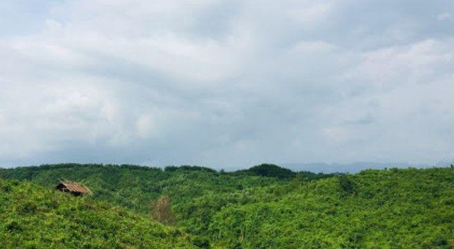
If you are a native Bangladeshi who loves exploring different places, it is hard not to hear the names Bisnadakandi and Jaflong. However, if you want to know more about the surrounding locations and the neighborhoods around them, all you have to do is look at the Gowainghat area guide. But before that, let’s learn about Gowainghat.<br><br> Gowainghat is an upazila of the Sylhet District in the northeast of Bangladesh. Since it is located near the Goyain River, the area was called Gowainghat. The British Government established the Gowainghat Thana in 1908, which included Araikha, Dhargram, Piyaingul, Panchbhag, and Jaflong. It also contains the history of the 1971 Liberation War and has 7 mass graves. In 1983, the Gowainghat Upazila was established, and now it has 13 unions and 264 villages.<br><br> The upazila has a land area of 486.10 square kilometers. According to the 2022 Census, the population of the area was 3,55,969. The other nearby locations of Gowainghat Upazila are the Jaintiapur Upazila, Sylhet Sadar Upazila, Companiganj Upazila, and Meghalaya of India. The main economy of the people in this upazila is agriculture. However, non-agricultural labor, trade and commerce, stone, coals, tea, tourists, etc., are also part of economic sources.<br><br> The Gowainghat Upazila has several notable locations and some of the most popular tourist spots in the country. Two of them are located in Jaflong and Bisnakandi. These are hilly areas, and they also have tee estates, river locations, waterfalls and attractive resorts. Another reason people like these places is because they provide an opportunity to get close to the Bangladesh-India border point.<br><br> Other than these, you can also enjoy the beauty of the Goyain River and Sari River. Some other notable locations of the Gowainghat Upazila include Ratargul Swamp Forest, Srihatta-Samdani Art Centre & Sculpture Park, Jaflong Khashia Jomidar Bari, Gowainghat Dighi, etc. The rural environment of the Gowainghat Upazila is a good place to live, as the Upazila Sadar area is developing. However, the rural areas still need better communication and lifestyle facilities. On top of that, several parts of the upazila are damaged every year due to floods and other natural causes.
View Insights
Jaintapur Property Guide
Rating icon
3.9

Jaintapur
, Sylhet

If you travel from Sylhet Sadar to Jaflong, you must first reach Jaintapur Upazila. Since Jaflong is one of Bangladesh's most popular tourist destinations, it is necessary to discuss the Jaintapur area guide. Closer to the Bangladesh-India borderline, Jaintapur Upazila stands with a mesmerizing and naturally beautiful landscape.<br><br> It is located in the northeast part of Sylhet City, 43 kilometers from it. The Jaintapur Upazila is bounded by India’s Meghalaya on the north, Golapganj and Kanaighat Upazilas on the south, Kanaighat Upazila on the east, and the Sylhet Sadar and Gowainghat Upazilas on the west. The upazila has 6 unions, 142 mouzas, and 174 villages.<br><br> According to the 2022 Census, the upazila has a population of 2,00,128, and the land area is around 256.69 square kilometers. The majority of the population in the upazila is Muslims, but there are also Hindus, Buddhists, Christians, and other religious people living together. The Khasia community also belongs to the Jaintapur upazila. As a result, it offers cultural and festival diversity in the area, making the community favorable to live in. Moreover, house rent in the upazila village areas is more affordable than in the upazila town areas.<br><br> The economy of the upazila is driven by agriculture and employs 53.38% of the population here. Tea, paddy, bay leaf, betel leaf, potato, etc, are some of the main crops of the upazila. However, industrial sectors, non-agricultural labor, businesses, transport and communication, etc., are also contributing to the economy of the upazila. There are many export products in the upazila, such as natural gas, limestone, pebble, tea, bay leaf, betel leaf, and nut.<br><br> The upazila offers a diverse range of public services and infrastructure, from a health complex, clinics, and post offices to educational institutions, banks, and haat-bazars. The most notable educational institutions in the upazila are Jaintiapur Government High School, Haripur High School, Jaintia Degree College, Jaintiapur Tayob Ali Degree College, etc.<br><br> Other than Jaflong tourist spots, you can enjoy many beautiful and notable landscapes in Jaintapur. Some of the popular ones are the Jaintia Rajbari, Shapla Beel, Mukambari Old Temple, Shreepur Tea Garden, etc. Tourists who want to stay overnight and spend their vacation in Jaintapur can stay at The Jaintia Resort & Park or the Nazimgarh Wilderness Resort. Notable waterbodies in the upazila are the Sari River, Kakai Beel, Lala Khal, and the Dalai Haor, which is also a popular tourist spot.
View Insights
Kachari Bazaar Property Guide
Rating icon
3.9

Kachari Bazaar
, Rangpur

Kachari Bazaar is located in the heart of Rangpur district. Near the Collectorate building which is one of the main landmarks of Rangpur. It is close to Rangpur Central Bus Terminal and Rangpur Medical College Hospital. It grew up in Rangpur city about a few decades ago, serving as a central location for trade and commerce. As Kachari Bazaar is centrally located in Rangpur, it is easily accessible from various parts of the city. Kachari Bazaar is not only a place for shopping but also serves as a cultural center. The market is known for its lively atmosphere. As Rangpur Judge Kot is located in Kachari Bazaar, the administrative system here is also quite satisfactory.<br><br> The market plays an important role in the local economy and also enriches the economy of Rangpur district. Enables small business owners, shopkeepers and vendors to earn a living. The market also offers a wider range of products including fresh produce, spices, clothing and electronic unique household items. Which caters to the needs of local residents as well as distant people.<br><br> People who are close to the market are likely to have access to shopping, banking and everyday conveniences. Besides, the area's central location within Rangpur provides easy access to educational institutions, hospitals and other important offices including government offices. Rangpur's well-known schools, colleges and universities, medical colleges ensure the educational system here. There are various government and private hospitals and private clinics for treatment. And if the communication system is good here, people will be interested to live here. Especially the road connectivity is better.<br><br> The market is busy in the morning and late afternoon. Rangpur Kachari Bazaar also has many specialties. It is a commercial hub of Rangpur city. The famous street food of Rangpur is very good here. Besides, the market reflects Rangpur's place of Sanskrit tradition that gives a glimpse into the life of the city's residents. It is a place where cultures are exchanged and traditional practices are maintained.<br><br> Here the religious harmony is strong as well as the touch of communalism is quite evident. The coexistence of the people here, the sociability, the hospitality style, the ethics etc. it reminds me of the old traditions of Rangpur which is really nice.<br><br> Overall, Kachari Bazar reflects the economic heartbeat of Rangpur's historic culture, making this part an important part of the city that is admirable.
View Insights
Kalizira Property Guide
Rating icon
3.9

Kalizira
, Barishal

Kalizira is an area of ​​Barisal city located in the southern region of Bangladesh and is under the City Corporation. Kalizira is accessible from the central part of Barisal and is connected by local roads. Kalizira is just 4.3 km from Barisal Zero Point. Kalizira is mainly a residential area with traditional houses and modern buildings. The area has a vibrant community life with a mix of religious and cultural events. There are mosques and unique religious centers where residents have opportunities for prayer and religious activities that truly strengthen the bond of harmony.<br><br> Kalizira's economy is centered on small businesses, retail shops, bazaars and bazaars. Local people here are involved in market activities and small businesses. Besides, the people of this area are engaged in various professions including jobs which contribute to the local economy.<br><br> Kalizira, like the Ananya part of Barisal, is also slowly undergoing urbanization. Infrastructure is being improved with the development of new roads, buildings and amenities. Kalizira is also considered a safe area to live in with a relatively low crime rate. Along with this it will provide you a decent life.<br><br> There are area-based small health care centers and clinics that provide primary care to the locals. Barisal headquarters for emergency services have access to advanced medical facilities and are well connected by road. There are public and private primary and secondary schools for education here. Also for higher education there are Barisal University and Barisal Medical College which are within commuting distance of people here.<br><br> Kalizira is well connected with the rest of Barisal by local roads and public transport. Part of Barisal, Kalizira benefits from the natural beauty of the region, including the surrounding rivers and green spaces.<br><br> The area is still developing, with gradual urbanization and infrastructure improvements making it a promising area for long-term living. Benefit from ongoing projects to enhance the livability of the area.<br><br> Overall, people prefer living in Kalizira for its affordability, sense of community, convenient access to amenities and peaceful environment. It is particularly suitable for families and those looking for a balance between city life and a more relaxed lifestyle.
View Insights
IconMap

Featured Projects

View All

Property Price Trends in Bangladesh for
Buy
Rent
Bedrooms:
Average Price (Last 12 months)
BDT 6,428.06 per sqft
Past 12 months' growth
11.11%
Positive Trend
Past 3 months' growth
13.4%
Positive Trend
Icon
Price information is based on historical data from ads posted on Bikroy and may not reflect the full market dynamics.
hero

Sell or Rent Fast on Bikroy: Post Your Property in 2 Mins!